
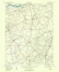
~ Barclay MD topo map, 1:62500 scale, 15 X 15 Minute, Historical, 1951
Barclay, Maryland, USGS topographic map dated 1951.
Includes geographic coordinates (latitude and longitude). This topographic map is suitable for hiking, camping, and exploring, or framing it as a wall map.
Printed on-demand using high resolution imagery, on heavy weight and acid free paper, or alternatively on a variety of synthetic materials.
Topos available on paper, Waterproof, Poly, or Tyvek. Usually shipping rolled, unless combined with other folded maps in one order.
- Product Number: USGS-5367946
- Free digital map download (high-resolution, GeoPDF): Barclay, Maryland (file size: 6 MB)
- Map Size: please refer to the dimensions of the GeoPDF map above
- Weight (paper map): ca. 55 grams
- Map Type: POD USGS Topographic Map
- Map Series: HTMC
- Map Verison: Historical
- Cell ID: 50943
- Scan ID: 257300
- Visual Version Number: 1
- Aerial Photo Year: 1947
- Field Check Year: 1948
- Datum: NAD27
- Map Projection: Polyconic
- Map published by United States Geological Survey
- Map published by United States Army Corps of Engineers
- Map published by United States Department of Commerce
- Map Language: English
- Scanner Resolution: 600 dpi
- Map Cell Name: Barclay
- Grid size: 15 X 15 Minute
- Date on map: 1951
- Map Scale: 1:62500
- Geographical region: Maryland, United States
Neighboring Maps:
All neighboring USGS topo maps are available for sale online at a variety of scales.
Spatial coverage:
Topo map Barclay, Maryland, covers the geographical area associated the following places:
- Church Hill - Roe - McGinnes - Cleaves Fork - Templeville - Ben Lee Estates - Melville Crossroads - Ingleside - Duhamel Corners - Ewingville - The Meadows - Pondtown - Dudley Corners - Baltimore Corner - Deans Meadows - The Village at Church Hill Crossing - Price - Union Corner - Pheasantfield - Ford Landing - Piney Shores - Sagefield - Henderson - Kirby Landing - Choptank Pines - Spry Landing - Unicorn - Lyn Woods - Barclay - Unicorn Manor - Sudlersville - Crumpton - Lynn Woods - Hope - Pine Cove - The Plains - Deep Landing - Mussel Shoals - Busic - Pearson Grove - Bolton - Bridgetown - Stevens Corner - Roberts - Caroline Acres Mobile Home Park - Peters Corners - Springview - Char-Nor Manor - Double Creek Wood - Hayden - Cronshaw - Weidman - Goldsboro - Hollingsworth Circle - Kane Crossroads - Pine Springs Mobile Home Park - Newmans Corner - Ruthsburg - Mount Zion
- Map Area ID: AREA39.2539-76-75.75
- Northwest corner Lat/Long code: USGSNW39.25-76
- Northeast corner Lat/Long code: USGSNE39.25-75.75
- Southwest corner Lat/Long code: USGSSW39-76
- Southeast corner Lat/Long code: USGSSE39-75.75
- Northern map edge Latitude: 39.25
- Southern map edge Latitude: 39
- Western map edge Longitude: -76
- Eastern map edge Longitude: -75.75


