
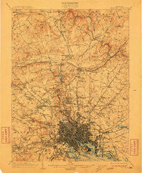
~ Baltimore MD topo map, 1:62500 scale, 15 X 15 Minute, Historical, 1904, updated 1911
Baltimore, Maryland, USGS topographic map dated 1904.
Includes geographic coordinates (latitude and longitude). This topographic map is suitable for hiking, camping, and exploring, or framing it as a wall map.
Printed on-demand using high resolution imagery, on heavy weight and acid free paper, or alternatively on a variety of synthetic materials.
Topos available on paper, Waterproof, Poly, or Tyvek. Usually shipping rolled, unless combined with other folded maps in one order.
- Product Number: USGS-5367936
- Free digital map download (high-resolution, GeoPDF): Baltimore, Maryland (file size: 10 MB)
- Map Size: please refer to the dimensions of the GeoPDF map above
- Weight (paper map): ca. 55 grams
- Map Type: POD USGS Topographic Map
- Map Series: HTMC
- Map Verison: Historical
- Cell ID: 50921
- Scan ID: 257290
- Imprint Year: 1911
- Survey Year: 1902
- Datum: Unstated
- Map Projection: Unstated
- Map published by United States Geological Survey
- Map Language: English
- Scanner Resolution: 600 dpi
- Map Cell Name: Baltimore
- Grid size: 15 X 15 Minute
- Date on map: 1904
- Map Scale: 1:62500
- Geographical region: Maryland, United States
Neighboring Maps:
All neighboring USGS topo maps are available for sale online at a variety of scales.
Spatial coverage:
Topo map Baltimore, Maryland, covers the geographical area associated the following places:
- Bridleshire - West Forest Park - Loch Raven Village - Govanstown - Glenside Park - Little Italy - Fulton - Southland Hills - Anthonyville - Beechfield - The Willows of Ruxton - North Wind - Hampton Gardens - Meadowcliff - Woodward - Broadway-Orleans Homes - Mount Clare - Stab - Idlewood - College Hills - Rolling Road Farms - Windsor Terrace - Summer Hill - Overlook - Shoresville (historical) - Mount Washington - Eastpoint - Rockland Run - Shetland Hills - Mount Vernon - Dickeyville - Dumbarton - Hampton - Valley Stream - The Lakes - Chestnut Ridge - Hillside at Seminary - Brightside (historical) - Oak Hill - Long Green - Parkside Heights - Brookwood - Valley Heights - Ridgemont - Mount Hope - Valewood at Hampton Gardens - Glenmar - Colgate - Sorrento Run - Providence - Walbrook - Baltimore - Minersville (historical) - Dembeigh Hill - Dulaney Hills - Pickwick - Kenwood - Boxwood - Sheppard (historical) - Defense Heights - Brightwood - Summerfield Farms - Sudbrook Park - Haywood Heights - The Falls - Morrell Park - Hunt Valley - Carney Grove - Huntspring - Clarence Perkins Homes - Jonathans Delight - Woodhome Heights - Loch Hill - Pineleigh - York Ridge - Ravenhurst - Glendale - Rosedale Terrace - Ruxton Hills - Seminary Overlook - Gallagher Park - Orchard Hills - Powhatan - Hampton Village - Melvale - Television Hill - Windsor Mill Manor - Ridge Grove - Pine Ridge - Martins Choice - Stratford - Village of Cross Keys - Wetheredsville - Hillendale - West Baltimore - Roland Park - Blenheim Manor - Liberty Mobile Home Park - Knettishall - Cockeysville
- Map Area ID: AREA39.539.25-76.75-76.5
- Northwest corner Lat/Long code: USGSNW39.5-76.75
- Northeast corner Lat/Long code: USGSNE39.5-76.5
- Southwest corner Lat/Long code: USGSSW39.25-76.75
- Southeast corner Lat/Long code: USGSSE39.25-76.5
- Northern map edge Latitude: 39.5
- Southern map edge Latitude: 39.25
- Western map edge Longitude: -76.75
- Eastern map edge Longitude: -76.5


