
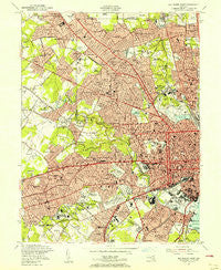
~ Baltimore West MD topo map, 1:24000 scale, 7.5 X 7.5 Minute, Historical, 1953, updated 1956
Baltimore West, Maryland, USGS topographic map dated 1953.
Includes geographic coordinates (latitude and longitude). This topographic map is suitable for hiking, camping, and exploring, or framing it as a wall map.
Printed on-demand using high resolution imagery, on heavy weight and acid free paper, or alternatively on a variety of synthetic materials.
Topos available on paper, Waterproof, Poly, or Tyvek. Usually shipping rolled, unless combined with other folded maps in one order.
- Product Number: USGS-5365692
- Free digital map download (high-resolution, GeoPDF): Baltimore West, Maryland (file size: 20 MB)
- Map Size: please refer to the dimensions of the GeoPDF map above
- Weight (paper map): ca. 55 grams
- Map Type: POD USGS Topographic Map
- Map Series: HTMC
- Map Verison: Historical
- Cell ID: 2294
- Scan ID: 256028
- Imprint Year: 1956
- Woodland Tint: Yes
- Aerial Photo Year: 1943
- Field Check Year: 1944
- Datum: NAD27
- Map Projection: Polyconic
- Map published by United States Army Corps of Engineers
- Map Language: English
- Scanner Resolution: 600 dpi
- Map Cell Name: Baltimore West
- Grid size: 7.5 X 7.5 Minute
- Date on map: 1953
- Map Scale: 1:24000
- Geographical region: Maryland, United States
Neighboring Maps:
All neighboring USGS topo maps are available for sale online at a variety of scales.
Spatial coverage:
Topo map Baltimore West, Maryland, covers the geographical area associated the following places:
- Asylum (historical) - Windsor Mill Manor - Cherry Hill - Calverton Heights - Howardsville - Windsor Terrace - Mount Winans - Powhatan Hill - Ten Hills - Rognel Heights - Westport - West Baltimore - Cheswolde - Dixon Hill - Charlestown - Woodberry - Fulton - Morrell Park - Kenwood - Harristown - Bloomsbury - Irvington - Westview Park - Gilmor Homes - Howard Park - Catonsville Manor - Featherbed - Walden Circle - Beechfield - Carroll - Windsor Hills - West Hills - Sudbrook Park - College Hills - Paradise - Colonial Village - Lochearn - Cold Spring - Wetheredsville - Television Hill - Catonsville Heights - Williamsburg - Academy Heights - Evergreen - Willow Glen - Mount Washington - Ralston - Glenmore Park - The Terraces - Arlington - Mondawmin - Dorchester Heights - Colonial Park - Arbutus - Brighton - Fallstaff - Norwood Heights - Rolling Road Farms - Pimlico - West Edmondale - Oaklee Village - Mount Royal - Milford - Hillsdale Green - Forest Park - Melvale - West Forest Park - Lakeland - Pikesville - Catonsville - Brigadoon - Gwynn Oak - Dickeyville - Edmondson Ridge - Euclid Heights - Woodmoor - Rutherford Green - Haywood Heights - Leahigh - Cylburn (historical) - Woodlawn - Minersville (historical) - Westowne - Claremont (historical) - Denmore Park - Mount Hope - Knollview - Franklintown - Calverton - Hunting Ridge - Edmondson Village - Wakefield - Pickwick - Violetville - North Bend - Oak Forest - Mount Clare - Roland Park - Oak Forest Park - Hampden
- Map Area ID: AREA39.37539.25-76.75-76.625
- Northwest corner Lat/Long code: USGSNW39.375-76.75
- Northeast corner Lat/Long code: USGSNE39.375-76.625
- Southwest corner Lat/Long code: USGSSW39.25-76.75
- Southeast corner Lat/Long code: USGSSE39.25-76.625
- Northern map edge Latitude: 39.375
- Southern map edge Latitude: 39.25
- Western map edge Longitude: -76.75
- Eastern map edge Longitude: -76.625


