
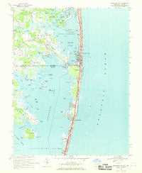
~ Assawoman Bay MD topo map, 1:24000 scale, 7.5 X 7.5 Minute, Historical, 1967, updated 1969
Assawoman Bay, Maryland, USGS topographic map dated 1967.
Includes geographic coordinates (latitude and longitude). This topographic map is suitable for hiking, camping, and exploring, or framing it as a wall map.
Printed on-demand using high resolution imagery, on heavy weight and acid free paper, or alternatively on a variety of synthetic materials.
Topos available on paper, Waterproof, Poly, or Tyvek. Usually shipping rolled, unless combined with other folded maps in one order.
- Product Number: USGS-5365658
- Free digital map download (high-resolution, GeoPDF): Assawoman Bay, Maryland (file size: 14 MB)
- Map Size: please refer to the dimensions of the GeoPDF map above
- Weight (paper map): ca. 55 grams
- Map Type: POD USGS Topographic Map
- Map Series: HTMC
- Map Verison: Historical
- Cell ID: 1717
- Scan ID: 256010
- Imprint Year: 1969
- Woodland Tint: Yes
- Aerial Photo Year: 1963
- Field Check Year: 1967
- Datum: NAD27
- Map Projection: Polyconic
- Map published by United States Geological Survey
- Map Language: English
- Scanner Resolution: 600 dpi
- Map Cell Name: Assawoman Bay
- Grid size: 7.5 X 7.5 Minute
- Date on map: 1967
- Map Scale: 1:24000
- Geographical region: Maryland, United States
Neighboring Maps:
All neighboring USGS topo maps are available for sale online at a variety of scales.
Spatial coverage:
Topo map Assawoman Bay, Maryland, covers the geographical area associated the following places:
- Bayside Keys - The Narrows - Montego Bay Mobile Home Park - Warrens Park - Caine Harbor Mile - Cape Windsor Mobile Home Park - Oak Acres - Peppers Landing - Mulberry Landing - Sea Dunes - The Shoals - Magnolia Shores - Seatowne - Queens Quest - Fenwick West - Fenwick Estates - Sassafras Landing - Montego Bay - Seaside Villas - Bayville - Edgewater Acres - Ocean Bay City - Keen-Wik - Indian Cove - Swann Keys - Fenwick Landing - Teaberry Woods - Keenwik West - Shady Park Mobile Home Park - Hidden Harbor - Fenwick Island - Caine Keys - Cainwoods - Kings Grant - Fenwick - Keenwik Sound
- Map Area ID: AREA38.538.375-75.125-75
- Northwest corner Lat/Long code: USGSNW38.5-75.125
- Northeast corner Lat/Long code: USGSNE38.5-75
- Southwest corner Lat/Long code: USGSSW38.375-75.125
- Southeast corner Lat/Long code: USGSSE38.375-75
- Northern map edge Latitude: 38.5
- Southern map edge Latitude: 38.375
- Western map edge Longitude: -75.125
- Eastern map edge Longitude: -75


