
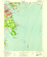
~ Annapolis MD topo map, 1:24000 scale, 7.5 X 7.5 Minute, Historical, 1957, updated 1958
Annapolis, Maryland, USGS topographic map dated 1957.
Includes geographic coordinates (latitude and longitude). This topographic map is suitable for hiking, camping, and exploring, or framing it as a wall map.
Printed on-demand using high resolution imagery, on heavy weight and acid free paper, or alternatively on a variety of synthetic materials.
Topos available on paper, Waterproof, Poly, or Tyvek. Usually shipping rolled, unless combined with other folded maps in one order.
- Product Number: USGS-5365638
- Free digital map download (high-resolution, GeoPDF): Annapolis, Maryland (file size: 9 MB)
- Map Size: please refer to the dimensions of the GeoPDF map above
- Weight (paper map): ca. 55 grams
- Map Type: POD USGS Topographic Map
- Map Series: HTMC
- Map Verison: Historical
- Cell ID: 1074
- Scan ID: 256000
- Imprint Year: 1958
- Woodland Tint: Yes
- Aerial Photo Year: 1955
- Field Check Year: 1957
- Datum: NAD27
- Map Projection: Polyconic
- Map published by United States Army Corps of Engineers
- Map Language: English
- Scanner Resolution: 600 dpi
- Map Cell Name: Annapolis
- Grid size: 7.5 X 7.5 Minute
- Date on map: 1957
- Map Scale: 1:24000
- Geographical region: Maryland, United States
Neighboring Maps:
All neighboring USGS topo maps are available for sale online at a variety of scales.
Spatial coverage:
Topo map Annapolis, Maryland, covers the geographical area associated the following places:
- Arundel on the Bay - Hillsmere Estates - Fishing Creek Farms - Tyler Heights - Providence Cove - Providence (historical) - Annapolis - New Point - Timber Creek - Blackwalnut Cove - Turkey Point - Colonial Manor Estates - Wardour Bluffs - Georgetown East - Bay Ridge - West Shoreham - Bembe Beach - Ferry Farms - Tanglewood - Lands End - Annapolis Roads - Elktonia - Hidden Point - Kitty Creek - West Annapolis - Annapolis Cove - Shoreham Beach - Old Annapolis Neck - Mariners Point - Colony Hills - Keys Farm - Watergate - Pendennis Mount - Bay View Heights - Hillsmere Shores - Town Home Village - Saunders Point - Watergate Village - Bloomsbury Square - Eastport Terrace - Oakwood - Oyster Harbor - Venice Beach - Round View - Eastport - Victor Haven - Beechwood on the Burley - Chrisland at Annapolis Cove - Wilshire - Highland Beach - Wardour - Walnut Lake - Anchorage
- Map Area ID: AREA3938.875-76.5-76.375
- Northwest corner Lat/Long code: USGSNW39-76.5
- Northeast corner Lat/Long code: USGSNE39-76.375
- Southwest corner Lat/Long code: USGSSW38.875-76.5
- Southeast corner Lat/Long code: USGSSE38.875-76.375
- Northern map edge Latitude: 39
- Southern map edge Latitude: 38.875
- Western map edge Longitude: -76.5
- Eastern map edge Longitude: -76.375


