
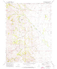
~ California Mtn NV topo map, 1:24000 scale, 7.5 X 7.5 Minute, Historical, 1971, updated 1974
California Mtn , Nevada, USGS topographic map dated 1971.
Includes geographic coordinates (latitude and longitude). This topographic map is suitable for hiking, camping, and exploring, or framing it as a wall map.
Printed on-demand using high resolution imagery, on heavy weight and acid free paper, or alternatively on a variety of synthetic materials.
Topos available on paper, Waterproof, Poly, or Tyvek. Usually shipping rolled, unless combined with other folded maps in one order.
- Product Number: USGS-5567326
- Free digital map download (high-resolution, GeoPDF): California Mtn , Nevada (file size: 11 MB)
- Map Size: please refer to the dimensions of the GeoPDF map above
- Weight (paper map): ca. 55 grams
- Map Type: POD USGS Topographic Map
- Map Series: HTMC
- Map Verison: Historical
- Cell ID: 6754
- Scan ID: 318307
- Imprint Year: 1974
- Woodland Tint: Yes
- Aerial Photo Year: 1968
- Field Check Year: 1971
- Datum: NAD27
- Map Projection: Transverse Mercator
- Map published by United States Geological Survey
- Map Language: English
- Scanner Resolution: 600 dpi
- Map Cell Name: California Mountain
- Grid size: 7.5 X 7.5 Minute
- Date on map: 1971
- Map Scale: 1:24000
- Geographical region: Nevada, United States
Neighboring Maps:
All neighboring USGS topo maps are available for sale online at a variety of scales.
Spatial coverage:
Topo map California Mtn , Nevada, covers the geographical area associated the following places:
- North Fork Pratt Creek - Jerritt Canyon Mine Fire and Emergency Medical Services - Independence Mountain - Evans Ranch - Jerritt Canyon Mill - Jerritt Canyon Mine - Middle Fork Winters Creek - North Fork Winters Creek - Jose Ranch - California Creek - Mahoney Spring - Steer Canyon - California Mountain - Deadmans Spring - Winters Creek - Arthenice Spring
- Map Area ID: AREA41.541.375-116-115.875
- Northwest corner Lat/Long code: USGSNW41.5-116
- Northeast corner Lat/Long code: USGSNE41.5-115.875
- Southwest corner Lat/Long code: USGSSW41.375-116
- Southeast corner Lat/Long code: USGSSE41.375-115.875
- Northern map edge Latitude: 41.5
- Southern map edge Latitude: 41.375
- Western map edge Longitude: -116
- Eastern map edge Longitude: -115.875


