
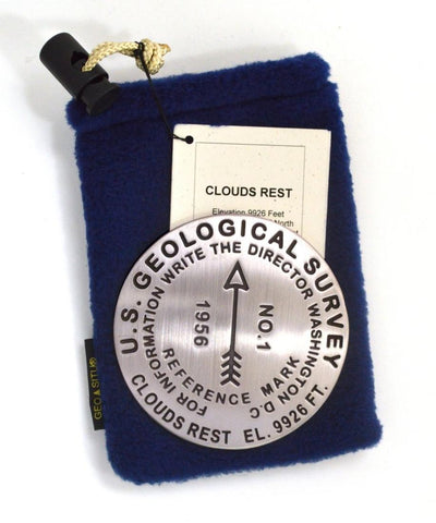
Clouds Rest, Yosemite National Park, California paperweight
3 1/4 inch diameter
Cast in fine pewter
Felt backing
With soft fleece pouch
In clear-vinyl covered box
PLACE NAME: Clouds Rest
ELEVATION: 9,926 ft.
COORDINATES: N37° 46 04 W119° 29 18
LOCATION: Yosemite National Park, California, USA
MARKERSLEUTH PHOTO CONTRIBUTOR: Colin and Kevin Ahern, 2001
While Half Dome and El Capitan seem to get top billing when it comes to hiking Yosemite landmarks, a hike to the summit of Clouds Rest is second to none for its 360 degrees view of the surrounding park and beyond. The narrow ridge to the summit and the sheer drop off to the north exhilarates even the most experienced hiker. The hike is about 14 miles, round trip, and is rated strenuous.
- Product Number: GSU_PW_CLOUD
- Reference Product Number: 2306090M
- ISBN: - None -
- Map format: - None -
- Map type: Accessories - Other Accessories
- Geographical region: United States
- Geographical subregion: California


