
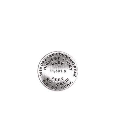
San Gorgonio, California lapel pin
1 inch diameter
Cast in fine pewter
Military clutch back
Mounted on story card
PLACE NAME: San Gorgonio Mountain
ELEVATION: 11,499 ft.
COORDINATES: N34° 06 02 W116° 49 40
LOCATION: San Gorgonio Wilderness, California, USA
MARKERSLEUTH PHOTO CONTRIBUTOR: Andrew Pelz, 1996
San Gorgonio Mountain is situated in the middle of San Gorgonio Wilderness and is the highest point in Southern California. The first recorded ascent was by Watson A. Goodyear of the California State Geological Survey and Mark Thomas of San Bernardino on June 2, 1872. Although the official elevation is 11,499 feet, a 1989 survey using GPS technology determined its elevation to be 11,501.6 feet.
The mountain is enjoyed for its hiking trails, winter snowboarding, and the expansive view from its summit. The wilderness is home to deer, mountain lions, black bears and bighorn sheep.
- Product Number: GSU_PN_SANGORGON
- Reference Product Number: 2306032M
- ISBN: - None -
- Map format: - None -
- Map type: Accessories - Pins
- Geographical region: United States
- Geographical subregion: California


