
California : Hawaii lighthouses
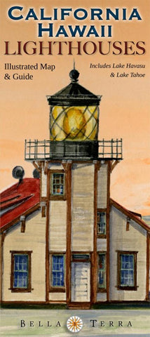
This beautifully illustrated map and guide locates all 52 standing and 30 lost lighthouses in California and Hawaii, along with lighthouse and maritime museums, on detailed shaded relief maps. With insets for Lake Havasu, Lake Tahoe and the Bay Area, and 31 specially commissioned watercolor illustrations. The guide on Side 2 has as much information as a book, including: history and description of each standing and lost lighthouse; driving directions to each standing light or the best viewing spots; boat lines and sightseeing flights that offer visits or views. A “Fast Facts” section has directories of lighthouse cruises, island ferries and sightseeing flights; and the museums located on the map; plus little-known True Tales of California and Hawaii lighthouses. Printed on paper.
- Product Number: BTP_CA_HI_LIGHT_16
- Reference Product Number: 2065645M
- ISBN: 9781888216400
- Date of Publication: 6/1/2016
- Folded Size: 9.06 inches high by 3.94 inches wide
- Unfolded (flat) Size: 24.02 inches high by 35.83 inches wide
- Map format: Folded
- Map type: Trade Maps - Specialty
- Geographical region: United States
- Geographical subregion: California,Hawaii


