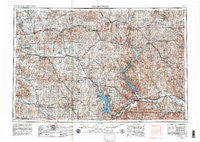
~ Manhattan KS topo map, 1:250000 scale, 1 X 2 Degree, Historical, 1955, updated 1980
Manhattan, Kansas, USGS topographic map dated 1955.
Includes geographic coordinates (latitude and longitude). This topographic map is suitable for hiking, camping, and exploring, or framing it as a wall map.
Printed on-demand using high resolution imagery, on heavy weight and acid free paper, or alternatively on a variety of synthetic materials.
Topos available on paper, Waterproof, Poly, or Tyvek. Usually shipping rolled, unless combined with other folded maps in one order.
- Product Number: USGS-5972332
- Free digital map download (high-resolution, GeoPDF): Manhattan, Kansas (file size: 15 MB)
- Map Size: please refer to the dimensions of the GeoPDF map above
- Weight (paper map): ca. 55 grams
- Map Type: POD USGS Topographic Map
- Map Series: HTMC
- Map Verison: Historical
- Cell ID: 72237
- Scan ID: 801878
- Imprint Year: 1980
- Woodland Tint: Yes
- Aerial Photo Year: 1954
- Edit Year: 1969
- Field Check Year: 1955
- Datum: NAD27
- Map Projection: Transverse Mercator
- Map published by United States Geological Survey
- Map published by: Military, Other
- Map Language: English
- Scanner Resolution: 508 dpi
- Map Cell Name: Manhattan
- Grid size: 1 X 2 Degree
- Date on map: 1955
- Map Scale: 1:250000
- Geographical region: Kansas, United States
Neighboring Maps:
All neighboring USGS topo maps are available for sale online at a variety of scales.
Spatial coverage:
Topo map Manhattan, Kansas, covers the geographical area associated the following places:
- Miller Mobile Home Court - Flush - Carden - Winkler - Norway - Rice - Pillsbury Crossing - Miltonvale - Frankfort - J and L Mobile Home Park - Grandview Plaza - Corning - Harbine - Colonial Gardens Mobile Homes - Rosaco - Sunset Park - Narka - Washington - Ladysmith - Sumnerville - America City - Waterville - Ames - Lasita - Scottish Square Mobile Home Park - Delphos - Strawberry - Swamp Angel - Cuba - Longford - Alida - Blaine - Humdinger Trailer Park - Oscar (historical) - Linn - Junction City Regency Mobile Home Park - Black Squirrel Mobile Home Park - Zeandale - Vining - Vera - Rydal - Country Acres Trailer Court - Mobile Villa Trailer Court - Moonlight - Louisville - Neuchatel - Kelly - Sullivan - Saint Bridget - Lillis - Bretz's Mobile Home Park - Bluemont Hill - Marietta - Axtell - Herkimer - Marysville - Belleville - Belvue - Riverchase Mobile Home Park - Talmo - Blue Rapids - Midway Mobile Home Park - Wayne - Milo - Bennington - Riverside Mobile Home Park - Bremen - Scottsville - Duluth - Alcove Spring - Brantford - Haworth - Coursens Grove (historical) - Seneca - Spence - Blue Valley Mobile Home Park - Baileyville - Formoso - Alma - Sherdahl - Centralia - Maple Hill - Olsburg - Ada - Morrowville - Riley - Oak Hill - Barnes - Wamego - Vliets - Ogden - Four Seasons Mobile Home Estates - Hollenberg - Reedsville - Fairmont - Oketo - Saint Clere - Mahaska - White Rock - Lewis Mobile Home Park
- Map Area ID: AREA4039-98-96
- Northwest corner Lat/Long code: USGSNW40-98
- Northeast corner Lat/Long code: USGSNE40-96
- Southwest corner Lat/Long code: USGSSW39-98
- Southeast corner Lat/Long code: USGSSE39-96
- Northern map edge Latitude: 40
- Southern map edge Latitude: 39
- Western map edge Longitude: -98
- Eastern map edge Longitude: -96