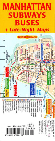
Manhattan subways buses : + late-night maps
Back to back, the Manhattan subway- and bus map face each other. This combination of maps shows intermodality - the ability to travel via subway and bus interchangeably - which is sometimes the only way to get from where you are to where you want to go in Manhattan. (Especially con-venient with free transfers between subways and buses with Metrocard.) There is an index of subway stations, an index of primary bus streets and terminals, and both maps are to the same scale and share the same grid co-ordinates. Plus there are late-night maps.
True to Tauranac’s belief that a transportation map should be more didactic than merely indicating full-time v. part-time service, the service on his maps is time specific – a red number or letter indicates that the service only operates weekdays, blue indicates that the service only operates rush hours, and so on.
Folded, the maps measure 3.3 by 8.3 inches, a comfortable size for pocket, purse, tote or backpack. Unfolded – and accordion
- Product Number: TAU_MAN_SUBBUS_11
- Reference Product Number: 2042425M
- ISBN: 9781878892287
- Date of Publication: 6/1/2011
- Folded Size: 8.27 inches high by 3.15 inches wide
- Unfolded (flat) Size: 8.27 inches high by 25.2 inches wide
- Map format: Folded
- Map type: Trade Maps - Tourist
- Geographical region: United States
- Geographical subregion: New York