
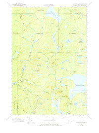
~ Allagash Lake ME topo map, 1:62500 scale, 15 X 15 Minute, Historical, 1961, updated 1979
Allagash Lake, Maine, USGS topographic map dated 1961.
Includes geographic coordinates (latitude and longitude). This topographic map is suitable for hiking, camping, and exploring, or framing it as a wall map.
Printed on-demand using high resolution imagery, on heavy weight and acid free paper, or alternatively on a variety of synthetic materials.
Topos available on paper, Waterproof, Poly, or Tyvek. Usually shipping rolled, unless combined with other folded maps in one order.
- Product Number: USGS-5683633
- Free digital map download (high-resolution, GeoPDF): Allagash Lake, Maine (file size: 5 MB)
- Map Size: please refer to the dimensions of the GeoPDF map above
- Weight (paper map): ca. 55 grams
- Map Type: POD USGS Topographic Map
- Map Series: HTMC
- Map Verison: Historical
- Cell ID: 50430
- Scan ID: 460082
- Imprint Year: 1979
- Woodland Tint: Yes
- Aerial Photo Year: 1958
- Field Check Year: 1961
- Datum: NAD27
- Map Projection: Polyconic
- Map published by United States Geological Survey
- Map Language: English
- Scanner Resolution: 600 dpi
- Map Cell Name: Allagash Lake
- Grid size: 15 X 15 Minute
- Date on map: 1961
- Map Scale: 1:62500
- Geographical region: Maine, United States
Neighboring Maps:
All neighboring USGS topo maps are available for sale online at a variety of scales.
Spatial coverage:
Topo map Allagash Lake, Maine, covers the geographical area associated the following places:
- T9 R15 WELS - Pine Brook - Mud Pond Ridge - T7 R14 WELS - Ice Cave Campsite - Little Wadleigh Pond - First South Branch Russell Pond - T7 R15 WELS - Fork Pond - Crescent Brook - Wadleigh Stream - Mud Pond - Mile Pond - Allagash Pond - Upper Ellis Pond - Mountain Pond - Round Pond Inlet Campsite - Narrow Pond - Allagash Lake - Gannett Brook - Poland Mountain - Frozen Ocean - Maple Ridge - Crescent Pond - Ross Inlet - Desolation Pond - Little Johnson Pond - Edes Campsite - Upper Russell Pond - T8 R14 WELS - West Branch Allagash Stream - Wadleigh Pond - Middle Russell Pond - North Branch Ross Inlet - Middle Branch Allagash Stream - South Branch Allagash Stream - Middle Brook - Poland Pond - Johnson Pond - Pine Pond - Sandy Point Campsite - Chemquasabamticook Lake - Mile Brook - Mountain Brook - Round Pond North Campsite - Ledge Point Campsite - Allagash Mountain - T8 R15 WELS - Corner Pond - East Branch Allagash Stream - Narrow Ridge - T9 R14 WELS - Narrow Brook - Carry Trail Campsite - Second South Branch Russell Pond
- Map Area ID: AREA46.546.25-69.75-69.5
- Northwest corner Lat/Long code: USGSNW46.5-69.75
- Northeast corner Lat/Long code: USGSNE46.5-69.5
- Southwest corner Lat/Long code: USGSSW46.25-69.75
- Southeast corner Lat/Long code: USGSSE46.25-69.5
- Northern map edge Latitude: 46.5
- Southern map edge Latitude: 46.25
- Western map edge Longitude: -69.75
- Eastern map edge Longitude: -69.5


