
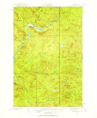
~ Allagash Falls ME topo map, 1:62500 scale, 15 X 15 Minute, Historical, 1932, updated 1957
Allagash Falls, Maine, USGS topographic map dated 1932.
Includes geographic coordinates (latitude and longitude). This topographic map is suitable for hiking, camping, and exploring, or framing it as a wall map.
Printed on-demand using high resolution imagery, on heavy weight and acid free paper, or alternatively on a variety of synthetic materials.
Topos available on paper, Waterproof, Poly, or Tyvek. Usually shipping rolled, unless combined with other folded maps in one order.
- Product Number: USGS-5683625
- Free digital map download (high-resolution, GeoPDF): Allagash Falls, Maine (file size: 9 MB)
- Map Size: please refer to the dimensions of the GeoPDF map above
- Weight (paper map): ca. 55 grams
- Map Type: POD USGS Topographic Map
- Map Series: HTMC
- Map Verison: Historical
- Cell ID: 50429
- Scan ID: 460078
- Imprint Year: 1957
- Woodland Tint: Yes
- Survey Year: 1932
- Datum: NAD27
- Map Projection: Polyconic
- Map published by United States Geological Survey
- Map Language: English
- Scanner Resolution: 600 dpi
- Map Cell Name: Allagash Falls
- Grid size: 15 X 15 Minute
- Date on map: 1932
- Map Scale: 1:62500
- Geographical region: Maine, United States
Neighboring Maps:
All neighboring USGS topo maps are available for sale online at a variety of scales.
Spatial coverage:
Topo map Allagash Falls, Maine, covers the geographical area associated the following places:
- Pelletier Deadwater Islands - Ben Glazier Brook - Finley Bogan - T14 R10 WELS - McKinnon Brook - Sag Pond - Musquacook Stream - Dead Horse Gulch - Sinclair Brook - T15 R11 WELS - McKeen Lake - T15 R10 WELS - Allagash Falls - McKeen Brook - Five Finger Brook - Rideout Cabin - Ramsay Brook - Round Pond Mountain - McKeen Camp - Rosies Rock - Unorganized Territory of Northwest Aroostook - T14 R11 WELS - McGargle Rocks - Petes Pond - Moores Farm - T13 R11 WELS - Squirrel Brook - Farm Brook - Cunliffe Depot Camp - Joe Martins Camp - Big Brook - Five Finger Camp - T13 R10 WELS - Musquacook Deadwater - Big Brook Lake - Bass Brook - Mink Pond - Little McKinnon Brook - Burntland Brook - Dows Camp - Bogan Brook - Michaud Farm - Rocky Brook - McKeen Island - The Corduroys - Moose Bogan
- Map Area ID: AREA4746.75-69.25-69
- Northwest corner Lat/Long code: USGSNW47-69.25
- Northeast corner Lat/Long code: USGSNE47-69
- Southwest corner Lat/Long code: USGSSW46.75-69.25
- Southeast corner Lat/Long code: USGSSE46.75-69
- Northern map edge Latitude: 47
- Southern map edge Latitude: 46.75
- Western map edge Longitude: -69.25
- Eastern map edge Longitude: -69


