
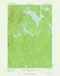
~ Caucomgomoc Lake ME topo map, 1:62500 scale, 15 X 15 Minute, Historical, 1958, updated 1961
Caucomgomoc Lake, Maine, USGS topographic map dated 1958.
Includes geographic coordinates (latitude and longitude). This topographic map is suitable for hiking, camping, and exploring, or framing it as a wall map.
Printed on-demand using high resolution imagery, on heavy weight and acid free paper, or alternatively on a variety of synthetic materials.
Topos available on paper, Waterproof, Poly, or Tyvek. Usually shipping rolled, unless combined with other folded maps in one order.
- Product Number: USGS-5536311
- Free digital map download (high-resolution, GeoPDF): Caucomgomoc Lake, Maine (file size: 6 MB)
- Map Size: please refer to the dimensions of the GeoPDF map above
- Weight (paper map): ca. 55 grams
- Map Type: POD USGS Topographic Map
- Map Series: HTMC
- Map Verison: Historical
- Cell ID: 52284
- Scan ID: 306517
- Imprint Year: 1961
- Woodland Tint: Yes
- Aerial Photo Year: 1957
- Field Check Year: 1958
- Datum: NAD27
- Map Projection: Polyconic
- Map published by United States Geological Survey
- Map Language: English
- Scanner Resolution: 600 dpi
- Map Cell Name: Caucomgomoc Lake
- Grid size: 15 X 15 Minute
- Date on map: 1958
- Map Scale: 1:62500
- Geographical region: Maine, United States
Neighboring Maps:
All neighboring USGS topo maps are available for sale online at a variety of scales.
Spatial coverage:
Topo map Caucomgomoc Lake, Maine, covers the geographical area associated the following places:
- Black Point - Little Wadleigh Stream - Tarbox Pond - Hubbard Point - Bear Pond - Middle Brook - Little Mucalsea Pond - Caucomgomoc Dam - T5 R15 WELS - Beaver Brook - Withey Bog - Caribou Dam (historical) - Caucomgomoc Mountain - Rowe Cove - Little Scott Brook - Bean Pot Pond - Loon Stream - Daggett Pond - T5 R14 WELS - Telephone Hill - Little Ciss Stream - Middle Brook - Sap Ridge - Little Hurd Pond - Kimble Brook - Fox Brook - Dead Man Brook - Bear Brook - Little Scott Pond - Avery Brook - Hurd Brook - Ross Cove - Avery Pond - Loon Lake - Shallow Stream - Post Brook - South Brook - Hurd Mountain - Big Scott Brook - Big Hurd Pond - The Horserace - Ramsell Brook - Smith Brook - Bear Brook Bog - Big Mucalsea Pond - Caucomgomoc Lake - T6 R14 WELS - North Brook - Round Pond - Loon Lake Dam - Rowe Pond - Little Scott Deadwater - Withey Brook - T6 R15 WELS - Gibert Brook - Caribou Deadwater (historical) - McDougal Pond - McGooseley Pond - Ciss Stream
- Map Area ID: AREA46.2546-69.75-69.5
- Northwest corner Lat/Long code: USGSNW46.25-69.75
- Northeast corner Lat/Long code: USGSNE46.25-69.5
- Southwest corner Lat/Long code: USGSSW46-69.75
- Southeast corner Lat/Long code: USGSSE46-69.5
- Northern map edge Latitude: 46.25
- Southern map edge Latitude: 46
- Western map edge Longitude: -69.75
- Eastern map edge Longitude: -69.5


