
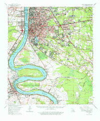
~ Baton Rouge LA topo map, 1:62500 scale, 15 X 15 Minute, Historical, 1963, updated 1977
Baton Rouge, Louisiana, USGS topographic map dated 1963.
Includes geographic coordinates (latitude and longitude). This topographic map is suitable for hiking, camping, and exploring, or framing it as a wall map.
Printed on-demand using high resolution imagery, on heavy weight and acid free paper, or alternatively on a variety of synthetic materials.
Topos available on paper, Waterproof, Poly, or Tyvek. Usually shipping rolled, unless combined with other folded maps in one order.
- Product Number: USGS-5593548
- Free digital map download (high-resolution, GeoPDF): Baton Rouge, Louisiana (file size: 10 MB)
- Map Size: please refer to the dimensions of the GeoPDF map above
- Weight (paper map): ca. 55 grams
- Map Type: POD USGS Topographic Map
- Map Series: HTMC
- Map Verison: Historical
- Cell ID: 51010
- Scan ID: 334254
- Imprint Year: 1977
- Woodland Tint: Yes
- Datum: NAD27
- Map Projection: Polyconic
- Map published by United States Geological Survey
- Map Language: English
- Scanner Resolution: 600 dpi
- Map Cell Name: Baton Rouge
- Grid size: 15 X 15 Minute
- Date on map: 1963
- Map Scale: 1:62500
- Geographical region: Louisiana, United States
Neighboring Maps:
All neighboring USGS topo maps are available for sale online at a variety of scales.
Spatial coverage:
Topo map Baton Rouge, Louisiana, covers the geographical area associated the following places:
- Quail Run - Airline Acres - Quail Hollow - Red Oak - Seneca Mobile Home Park - Brightside Park - The Shire - Walden - Jefferson Shadows - Soulouque - Riffel Place - Frisco (historical) - Fairmont - Smiley Heights - Woodstone Estates - Highland Crossing - Lake Forest Park - Country Manor - Oak Hill - Capital Heights - Goodwood - Rushmore - University South - Goodwood Homesites - McGehee Place - Bayou Fountain - East Sherwood Forest - Highlandia - Highland Road Estates - Longwood Court - Keaty Place - South Highlands - Park Forest - Progress - Lukeville - Melrose Place - Gardere Place - Lafitte Hill - Oakley - Hickory Ridge - McGrath Heights - Broadmoor Plaza - Bayou Paul - Chatsworth Acres - Royal Oak - Lakeland Terrace - Evangeline Hermitage Estates - Shamrock Plaza - Silverside Heights Garden - Normandy Acres - Standard Heights - Sherwood Oaks South - Stevendale Estates - Highland Community - Hillcrest Acres - The Hideaway - White Plains - West River Oaks - Essen Plaza - Del Rey Plaza - Oak Hills Place - Port Allen - Jefferson Terrace - Antioch Villa - Iberville Terrace - Parkview East - Burtville - Perkins Place - Plantation Mobile Home Park - Dent Terrace - Southpark - Audubon Terrace - Village Saint George - Meadow Lea - Sunnybrook - Greenwell Forest - College Park - College Drive Heights - Silverside - University Hills - Villa Del Rey Park - Tara - Kingsbridge - Briar Place - The Highlands - Kings Hill - Staring Acres - Kenilworth - Cedarcrest Mobile Home Park - Beaulieu - Greenville - Bell Fontaine - Stevensdale - Maribel Village - Acadian Place - Windfall - The Woodlands - Oakbrook - Tigerland Acres - Harwich
- Map Area ID: AREA30.530.25-91.25-91
- Northwest corner Lat/Long code: USGSNW30.5-91.25
- Northeast corner Lat/Long code: USGSNE30.5-91
- Southwest corner Lat/Long code: USGSSW30.25-91.25
- Southeast corner Lat/Long code: USGSSE30.25-91
- Northern map edge Latitude: 30.5
- Southern map edge Latitude: 30.25
- Western map edge Longitude: -91.25
- Eastern map edge Longitude: -91


