
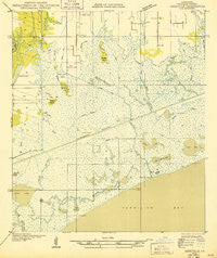
~ Abbeville SE LA topo map, 1:31680 scale, 7.5 X 7.5 Minute, Historical, 1932
Abbeville SE, Louisiana, USGS topographic map dated 1932.
Includes geographic coordinates (latitude and longitude). This topographic map is suitable for hiking, camping, and exploring, or framing it as a wall map.
Printed on-demand using high resolution imagery, on heavy weight and acid free paper, or alternatively on a variety of synthetic materials.
Topos available on paper, Waterproof, Poly, or Tyvek. Usually shipping rolled, unless combined with other folded maps in one order.
- Product Number: USGS-5592508
- Free digital map download (high-resolution, GeoPDF): Abbeville SE, Louisiana (file size: 5 MB)
- Map Size: please refer to the dimensions of the GeoPDF map above
- Weight (paper map): ca. 55 grams
- Map Type: POD USGS Topographic Map
- Map Series: HTMC
- Map Verison: Historical
- Cell ID: 19950
- Scan ID: 333607
- Woodland Tint: Yes
- Survey Year: 1932
- Datum: NAD27
- Map Projection: Polyconic
- Advance: Yes
- Planimetric: Yes
- Map published by United States Geological Survey
- Map Language: English
- Scanner Resolution: 600 dpi
- Map Cell Name: Hebert Lake
- Grid size: 7.5 X 7.5 Minute
- Date on map: 1932
- Map Scale: 1:31680
- Geographical region: Louisiana, United States
Neighboring Maps:
All neighboring USGS topo maps are available for sale online at a variety of scales.
Spatial coverage:
Topo map Abbeville SE, Louisiana, covers the geographical area associated the following places:
- Boston Bayou Oil and Gas Field - Onion Bayou - Bayou Chin - Onion Lake - Green Island Bayou - Lake Tripod - South Erath Gas Field - Long Lake - Bayou Hebert - Stump Island - Deer Bayou - Bayou Jack - Gum Island - Dugas Canal - Boston Canal - Marklee Island - Hog Lake - Live Oak Plantation - Live Oak Landing Strip - Landry Canal - Hebert Lake - Boston Bayou - Mayer Canal - Magee Canal - Nugier Canal - Mud Lake - Lake L'isle a Pete - Lake Cock - Peter Lee Island - Lake Bebe - Lake Cleodis - Maple Island - Bayou Mountine - North Bayou
- Map Area ID: AREA29.87529.75-92.125-92
- Northwest corner Lat/Long code: USGSNW29.875-92.125
- Northeast corner Lat/Long code: USGSNE29.875-92
- Southwest corner Lat/Long code: USGSSW29.75-92.125
- Southeast corner Lat/Long code: USGSSE29.75-92
- Northern map edge Latitude: 29.875
- Southern map edge Latitude: 29.75
- Western map edge Longitude: -92.125
- Eastern map edge Longitude: -92


