
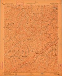
~ Whitesburg KY topo map, 1:125000 scale, 30 X 30 Minute, Historical, 1892, updated 1910
Whitesburg, Kentucky, USGS topographic map dated 1892.
Includes geographic coordinates (latitude and longitude). This topographic map is suitable for hiking, camping, and exploring, or framing it as a wall map.
Printed on-demand using high resolution imagery, on heavy weight and acid free paper, or alternatively on a variety of synthetic materials.
Topos available on paper, Waterproof, Poly, or Tyvek. Usually shipping rolled, unless combined with other folded maps in one order.
- Product Number: USGS-5930173
- Free digital map download (high-resolution, GeoPDF): Whitesburg, Kentucky (file size: 6 MB)
- Map Size: please refer to the dimensions of the GeoPDF map above
- Weight (paper map): ca. 55 grams
- Map Type: POD USGS Topographic Map
- Map Series: HTMC
- Map Verison: Historical
- Cell ID: 396093
- Scan ID: 804331
- Imprint Year: 1910
- Survey Year: 1885
- Datum: Unstated
- Map Projection: Unstated
- Map published by United States Geological Survey
- Map Language: English
- Scanner Resolution: 508 dpi
- Map Cell Name: Whitesburg
- Grid size: 30 X 30 Minute
- Date on map: 1892
- Map Scale: 1:125000
- Geographical region: Kentucky, United States
Neighboring Maps:
All neighboring USGS topo maps are available for sale online at a variety of scales.
Spatial coverage:
Topo map Whitesburg, Kentucky, covers the geographical area associated the following places:
- Potters Fork - Colson - Yorktown - Hemphill - Jacks Creek - Elimer - Smithsboro (historical) - Skyline - Little Dixie - Dema - Orkney - Rock Fork (historical) - Lionilli - Grethel - Hollybush - Martinsville (historical) - Craftsville (historical) - Brinkley - Cromona - Betty - Flat Gap - Gaskill - Collins - Marshal Branch (historical) - Kingdom Come (historical) - Wayland - Indian Bottom (historical) - Defeated Creek - Big Laurel - Neon Junction - East Jenkins - Weeksbury - Hi Hat - Ice - Right Fork of Long Fork (historical) - Puncheon - Short (historical) - Turkey Pen (historical) - Amelia - Tolliver Town - Garner - Cody (historical) - Hot Spot - Osborne Fork (historical) - Spider - Hurricane - Amburgey - Larkslane - Odgen Gap - Speight - Phipps - Baden - Yeager - Teaberry - Lick Fork (historical) - Hylton - Sackett - Lipps - Bolyn - Bottom Fork (historical) - Blackey - Linefork - Omaha - Robinson Creek - Porter (historical) - Bear Fork (historical) - May - Breeding Creek (historical) - North Fork - Hartley - Soft Shell - Smoot Creek (historical) - Upper Little Creek (historical) - Dewey - East McDowell - Oscaloosa - Upper Cumberland (historical) - Van - Thornton Gap - Sylvester (historical) - Neon - Harrolds Branch (historical) - Haddonfield - Porter Junction - Jeremiah - Leburn - Penny - Farraday - Pigeon - Tillie - Ellwood - Pauley - Dorton - Littcarr - Partridge - Adamson - Whitesburg - Letcher - Titan Siding - Redfox
- Map Area ID: AREA37.537-83-82.5
- Northwest corner Lat/Long code: USGSNW37.5-83
- Northeast corner Lat/Long code: USGSNE37.5-82.5
- Southwest corner Lat/Long code: USGSSW37-83
- Southeast corner Lat/Long code: USGSSE37-82.5
- Northern map edge Latitude: 37.5
- Southern map edge Latitude: 37
- Western map edge Longitude: -83
- Eastern map edge Longitude: -82.5


