
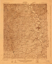
~ Cynthiana KY topo map, 1:48000 scale, 15 X 15 Minute, Historical, 1929
Cynthiana, Kentucky, USGS topographic map dated 1929.
Includes geographic coordinates (latitude and longitude). This topographic map is suitable for hiking, camping, and exploring, or framing it as a wall map.
Printed on-demand using high resolution imagery, on heavy weight and acid free paper, or alternatively on a variety of synthetic materials.
Topos available on paper, Waterproof, Poly, or Tyvek. Usually shipping rolled, unless combined with other folded maps in one order.
- Product Number: USGS-5678532
- Free digital map download (high-resolution, GeoPDF): Cynthiana, Kentucky (file size: 11 MB)
- Map Size: please refer to the dimensions of the GeoPDF map above
- Weight (paper map): ca. 55 grams
- Map Type: POD USGS Topographic Map
- Map Series: HTMC
- Map Verison: Historical
- Cell ID: 53169
- Scan ID: 804161
- Survey Year: 1929
- Datum: NAD
- Map Projection: Polyconic
- Advance: Yes
- Map published by United States Geological Survey
- Keywords: Overedge; Nonstandard Press Run
- Map Language: English
- Scanner Resolution: 508 dpi
- Map Cell Name: Cynthiana
- Grid size: 15 X 15 Minute
- Date on map: 1929
- Map Scale: 1:48000
- Geographical region: Kentucky, United States
Neighboring Maps:
All neighboring USGS topo maps are available for sale online at a variety of scales.
Spatial coverage:
Topo map Cynthiana, Kentucky, covers the geographical area associated the following places:
- Shawhan - Davis - Cedar Brook - Renaker - Curry (historical) - Breckinridge - Rutland - Connersville - Broadwell - Kiserton - Lair - Poindexter - Currentsville - Dutch Chapel (historical) - Robinson - White Oak (historical) - Lees Lick - Alberta - Belmont - Cynthiana - Leesburg - Garnett - Jacksonville - Ewalt Crossroads
- Map Area ID: AREA38.538.25-84.5-84.25
- Northwest corner Lat/Long code: USGSNW38.5-84.5
- Northeast corner Lat/Long code: USGSNE38.5-84.25
- Southwest corner Lat/Long code: USGSSW38.25-84.5
- Southeast corner Lat/Long code: USGSSE38.25-84.25
- Northern map edge Latitude: 38.5
- Southern map edge Latitude: 38.25
- Western map edge Longitude: -84.5
- Eastern map edge Longitude: -84.25


