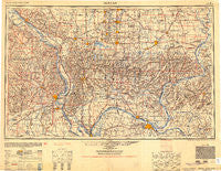
~ Paducah KY topo map, 1:250000 scale, 1 X 2 Degree, Historical, 1954
Paducah, Kentucky, USGS topographic map dated 1954.
Includes geographic coordinates (latitude and longitude). This topographic map is suitable for hiking, camping, and exploring, or framing it as a wall map.
Printed on-demand using high resolution imagery, on heavy weight and acid free paper, or alternatively on a variety of synthetic materials.
Topos available on paper, Waterproof, Poly, or Tyvek. Usually shipping rolled, unless combined with other folded maps in one order.
- Product Number: USGS-5631167
- Free digital map download (high-resolution, GeoPDF): Paducah, Kentucky (file size: 16 MB)
- Map Size: please refer to the dimensions of the GeoPDF map above
- Weight (paper map): ca. 55 grams
- Map Type: POD USGS Topographic Map
- Map Series: HTMC
- Map Verison: Historical
- Cell ID: 68951
- Scan ID: 707508
- Aerial Photo Year: 1942
- Datum: NAD27
- Map Projection: Transverse Mercator
- Shaded Relief map: Yes
- Map published by United States Army Corps of Engineers
- Map published by United States Army
- Map Language: English
- Scanner Resolution: 508 dpi
- Map Cell Name: Paducah
- Grid size: 1 X 2 Degree
- Date on map: 1954
- Map Scale: 1:250000
- Geographical region: Kentucky, United States
Neighboring Maps:
All neighboring USGS topo maps are available for sale online at a variety of scales.
Spatial coverage:
Topo map Paducah, Kentucky, covers the geographical area associated the following places:
- Carmack - New York (historical) - Fopal - Blackburn - Spillertown - Brazeau - Urbain - The Hall - Leemon - Cottonwood - Toga - Balcom - Midway - Woodville - Cliff - Bells Mine (historical) - Pleasant Grove (historical) - Garden Heights - Millheim - Lick Creek - Eichorn - Big Bay - Dissen - Livingston (historical) - Hines Landing - Bainbridge - Gowins - Wine Hill - Jonesboro - Herod - Pleasant Grove - Neilson - Raleigh - Mullikin Junction - Altenburg - Julien Hill - Karbers Ridge - Piney Fork - West Point - Hartle Ford - Shakerag - Coello - Oscar - Sand Ridge - Muddy - Dale - Gibsonia - Upper Hodge Landing - Roth - Friedheim - Glendale (historical) - Sheridan - Dixon Springs - Hurst - New Grand Chain - Harco - Rock - Wartrace - Chiles - West Vienna - Mound City - Zeigler - Whitesville (historical) - Buena Vista - Vienna - Omar - Ava - Fairview - Perkins (historical) - Gaskins City - Cornerville - West Paducah - Round Knob - Deer Ridge - Cooper Landing - Irma - Wolf Creek - East Cairo (historical) - Grubbs - Scopus - Fredonia - Lake Creek - Unionville - Price Landing - La Rue - Anna - Cave-in-Rock - Orient - Klondike - White Hill - Herald - Kurreville - Stiritz - Fairview - Reily Lake - Tuckers Corners - Saratoga - Kevil - Cambria - Elm Grove (historical)
- Map Area ID: AREA3837-90-88
- Northwest corner Lat/Long code: USGSNW38-90
- Northeast corner Lat/Long code: USGSNE38-88
- Southwest corner Lat/Long code: USGSSW37-90
- Southeast corner Lat/Long code: USGSSE37-88
- Northern map edge Latitude: 38
- Southern map edge Latitude: 37
- Western map edge Longitude: -90
- Eastern map edge Longitude: -88

