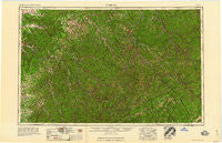
~ Jenkins KY topo map, 1:250000 scale, 1 X 2 Degree, Historical, 1960
Jenkins, Kentucky, USGS topographic map dated 1960.
Includes geographic coordinates (latitude and longitude). This topographic map is suitable for hiking, camping, and exploring, or framing it as a wall map.
Printed on-demand using high resolution imagery, on heavy weight and acid free paper, or alternatively on a variety of synthetic materials.
Topos available on paper, Waterproof, Poly, or Tyvek. Usually shipping rolled, unless combined with other folded maps in one order.
- Product Number: USGS-5295012
- Free digital map download (high-resolution, GeoPDF): Jenkins, Kentucky (file size: 14 MB)
- Map Size: please refer to the dimensions of the GeoPDF map above
- Weight (paper map): ca. 55 grams
- Map Type: POD USGS Topographic Map
- Map Series: HTMC
- Map Verison: Historical
- Cell ID: 74984
- Scan ID: 803657
- Woodland Tint: Yes
- Field Check Year: 1957
- Datum: Unstated
- Map Projection: Transverse Mercator
- Map published by United States Geological Survey
- Map published by United States Army Corps of Engineers
- Map published by United States Army
- Map Language: English
- Scanner Resolution: 508 dpi
- Map Cell Name: Jenkins
- Grid size: 1 X 2 Degree
- Date on map: 1960
- Map Scale: 1:250000
- Geographical region: Kentucky, United States
Neighboring Maps:
All neighboring USGS topo maps are available for sale online at a variety of scales.
Spatial coverage:
Topo map Jenkins, Kentucky, covers the geographical area associated the following places:
- Jonkan (historical) - Flatgap - Wiscoal - Black Creek (historical) - Slemp - Mikegrady - Puncheon - Defiance - Porter Junction - Carcassonne - Aflex - Bays Branch - Nero - Davenport - Ever - Breeding Creek (historical) - Wittensville - Ulvah - Gordon Ford - Rasnake - Big Spring Neighborhood (historical) - Phico - Rawl - Fishtrap (historical) - Sydnor Addition - Napfor - Zachariah - Indian Bottom (historical) - Lyons - Keel Addition (historical) - Saint Helens - West Prestonsburg - Halcyon - Barker Branch (historical) - Hoskinston - Stringtown - Elkfork - Selwyn - Blackwater - Tom Ray (historical) - Camargo - Means - Wolf Coal - Clear Fork (historical) - Dunham - Wolverine - Trimble Bend (historical) - Frozen Creek - Godby Heights - Whitesburg - Lovely - Jackson - Canada - Endee - Soft Shell - Twentysix - Woodman - Mayo Village - Helechawa - Barnabus - Ammie - Hardshell - Haddonfield - Council - Kragon - Proctor - Hatfield - Paint Creek (historical) - Pence - Upper White Oak Creek (historical) - Bias - Straight Creek (historical) - Omaha - Lunah - Millet (historical) - Diablock - Lookout - Wells Fork - Zoe - Bee - Bradshaw - Portsmouth - Bevins Branch (historical) - Sharondale - Little Floyd County (historical) - Pleasant Neighborhood (historical) - Lowmansville - Meades Branch (historical) - Baisden - Mount Gay - Mount Olive - Ivel - Hunter - Cornettsville - Banner - Lakeville - Vancleve - Lost Creek (historical) - Pebworth - Royrader
- Map Area ID: AREA3837-84-82
- Northwest corner Lat/Long code: USGSNW38-84
- Northeast corner Lat/Long code: USGSNE38-82
- Southwest corner Lat/Long code: USGSSW37-84
- Southeast corner Lat/Long code: USGSSE37-82
- Northern map edge Latitude: 38
- Southern map edge Latitude: 37
- Western map edge Longitude: -84
- Eastern map edge Longitude: -82

