
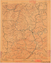
~ Williamsburg KY topo map, 1:125000 scale, 30 X 30 Minute, Historical, 1894, updated 1902
Williamsburg, Kentucky, USGS topographic map dated 1894.
Includes geographic coordinates (latitude and longitude). This topographic map is suitable for hiking, camping, and exploring, or framing it as a wall map.
Printed on-demand using high resolution imagery, on heavy weight and acid free paper, or alternatively on a variety of synthetic materials.
Topos available on paper, Waterproof, Poly, or Tyvek. Usually shipping rolled, unless combined with other folded maps in one order.
- Product Number: USGS-5294994
- Free digital map download (high-resolution, GeoPDF): Williamsburg, Kentucky (file size: 5 MB)
- Map Size: please refer to the dimensions of the GeoPDF map above
- Weight (paper map): ca. 55 grams
- Map Type: POD USGS Topographic Map
- Map Series: HTMC
- Map Verison: Historical
- Cell ID: 66951
- Scan ID: 804339
- Imprint Year: 1902
- Survey Year: 1887
- Datum: Unstated
- Map Projection: Unstated
- Map published by United States Geological Survey
- Map Language: English
- Scanner Resolution: 508 dpi
- Map Cell Name: Williamsburg
- Grid size: 30 X 30 Minute
- Date on map: 1894
- Map Scale: 1:125000
- Geographical region: Kentucky, United States
Neighboring Maps:
All neighboring USGS topo maps are available for sale online at a variety of scales.
Spatial coverage:
Topo map Williamsburg, Kentucky, covers the geographical area associated the following places:
- Hopewell - Ayers - Red Ash Coal Camp (historical) - Walden - Flat Rock - Hollyhill - Gatliff - Chaska - Perkins - Nevisdale - Little White Oak - Scuffletown - Oswego - Red Ash - Goldbug - Wooldridge - Duckrun - Whitley City - Balltown - Hickory Grove - Gray - Grove - Pine Hill - Savoy - Isham - Woodbine - Corbin - Sawyer - Revelo - Piney Grove - White Oak - Silerville - Yaden - Moore Hill - Louden Coal Camp (historical) - Morley - Emlyn - Jellico Creek - Marshes Siding - Faber - Bauer - Packard - Beulah Heights - Hail - Liberty - Newcomb - Julip - Bon - Watts Creek Jellico Coal Company (historical) - Hargis - Highcliff - Louden - Creekmore - Highland Park - Lucky - Verne - Woodland Estates - Clay Hill - Greenwood - Chestnut Grove (historical) - Camp Grounds - Shelly Knob Camp (historical) - Clio - Coal Mine (historical) - Mountain Ash - Strunk - Suttons Mill (historical) - Wofford - Dixie - State Line - Wiborg - Pleasant View - Wilton - Vox - Saxton - Redbird - North Corbin - Winfield - Lot - Jellico - Pine Knot - Stinking Creek - Rockholds - Dorthae - Fairview - Tackett Creek - Honeybee - Dal - Baldrock - Holton - Funston - Ketchen - Gilreath - Siler - Pleasant Grove - Stearns - Blue John - Williamsburg - Youngs Creek
- Map Area ID: AREA3736.5-84.5-84
- Northwest corner Lat/Long code: USGSNW37-84.5
- Northeast corner Lat/Long code: USGSNE37-84
- Southwest corner Lat/Long code: USGSSW36.5-84.5
- Southeast corner Lat/Long code: USGSSE36.5-84
- Northern map edge Latitude: 37
- Southern map edge Latitude: 36.5
- Western map edge Longitude: -84.5
- Eastern map edge Longitude: -84


