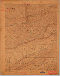
~ Jonesville KY topo map, 1:125000 scale, 30 X 30 Minute, Historical, 1887
Jonesville, Kentucky, USGS topographic map dated 1887.
Includes geographic coordinates (latitude and longitude). This topographic map is suitable for hiking, camping, and exploring, or framing it as a wall map.
Printed on-demand using high resolution imagery, on heavy weight and acid free paper, or alternatively on a variety of synthetic materials.
Topos available on paper, Waterproof, Poly, or Tyvek. Usually shipping rolled, unless combined with other folded maps in one order.
- Product Number: USGS-5294934
- Free digital map download (high-resolution, GeoPDF): Jonesville, Kentucky (file size: 5 MB)
- Map Size: please refer to the dimensions of the GeoPDF map above
- Weight (paper map): ca. 55 grams
- Map Type: POD USGS Topographic Map
- Map Series: HTMC
- Map Verison: Historical
- Cell ID: 65770
- Scan ID: 804223
- Survey Year: 1885
- Datum: Unstated
- Map Projection: Unstated
- Map published by United States Geological Survey
- Map Language: English
- Scanner Resolution: 508 dpi
- Map Cell Name: Jonesville
- Grid size: 30 X 30 Minute
- Date on map: 1887
- Map Scale: 1:125000
- Geographical region: Kentucky, United States
Neighboring Maps:
All neighboring USGS topo maps are available for sale online at a variety of scales.
Spatial coverage:
Topo map Jonesville, Kentucky, covers the geographical area associated the following places:
- Tway - Mayflower - Kincer Mill - Shields - Sand Hill - Evarts - Wilson Hill - Gatun - Clovertown - Cedar Hill - Benedict - Keith - Livesay Mill - Rex - Dizney - Dione - Sulphur Springs - Cawood - Mary Alice - Georgetown - Highsplint - Holmes Mill - Upper Laurel Fork (historical) - Napier - Yellow Springs - Insull - Rhea - Fresh Meadows - Dillon - Three Point - Nolansburg - Spruce Pine - Loyall - Evanston - Red Hill - Ben Hur - Sneedville - Sunnyside - Stone Creek - Sunshine - Turners Siding - Teetersville - Saylor - Draper - Colts - Cranks - Gibson Hall - Farmers Mill - Chevrolet - Rileyville - Martin Creek - Sampson - Monarch - Bobs Creek - Hockett - Helton - River Ridge - Fox Branch - South Wallins - Tin Can Alley (historical) - Woods - Hoop Creek - Molus - Ridgeway - Gilley - Jonesville Camp Ground - Caylor - Penn Lee - Closplint - Gano - Ten Spot - Chad - Black Bottom - Bonny Blue - Brookside - Oak Grove - Pine Mountain - Coldiron - Pathfork - Darbyville - Willis - Bondurant (historical) - Yeary Mill - Jonesville - Arthur - Kentenia - Short Town - Ramsey - Rock Hill - Big Laurel - Imperial (historical) - Putney - Redbud - Rose Hill - Gordon - Crummies - Eidson - Liggett - Boons Path - Yancey
- Map Area ID: AREA3736.5-83.5-83
- Northwest corner Lat/Long code: USGSNW37-83.5
- Northeast corner Lat/Long code: USGSNE37-83
- Southwest corner Lat/Long code: USGSSW36.5-83.5
- Southeast corner Lat/Long code: USGSSE36.5-83
- Northern map edge Latitude: 37
- Southern map edge Latitude: 36.5
- Western map edge Longitude: -83.5
- Eastern map edge Longitude: -83

