
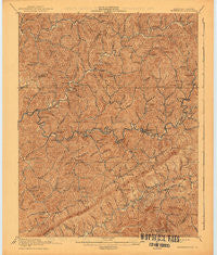
~ Whitesburg KY topo map, 1:62500 scale, 15 X 15 Minute, Historical, 1915, updated 1941
Whitesburg, Kentucky, USGS topographic map dated 1915.
Includes geographic coordinates (latitude and longitude). This topographic map is suitable for hiking, camping, and exploring, or framing it as a wall map.
Printed on-demand using high resolution imagery, on heavy weight and acid free paper, or alternatively on a variety of synthetic materials.
Topos available on paper, Waterproof, Poly, or Tyvek. Usually shipping rolled, unless combined with other folded maps in one order.
- Product Number: USGS-5294776
- Free digital map download (high-resolution, GeoPDF): Whitesburg, Kentucky (file size: 7 MB)
- Map Size: please refer to the dimensions of the GeoPDF map above
- Weight (paper map): ca. 55 grams
- Map Type: POD USGS Topographic Map
- Map Series: HTMC
- Map Verison: Historical
- Cell ID: 64490
- Scan ID: 804090
- Imprint Year: 1941
- Survey Year: 1913
- Datum: Unstated
- Map Projection: Polyconic
- Map published by United States Geological Survey
- Map Language: English
- Scanner Resolution: 508 dpi
- Map Cell Name: Whiteburg
- Grid size: 15 X 15 Minute
- Date on map: 1915
- Map Scale: 1:62500
- Geographical region: Kentucky, United States
Neighboring Maps:
All neighboring USGS topo maps are available for sale online at a variety of scales.
Spatial coverage:
Topo map Whitesburg, Kentucky, covers the geographical area associated the following places:
- Big Cowan (historical) - Whitco - Bath - Crafts Colly (historical) - Southdown - Middle Carr Creek (historical) - Littcarr - Mayking - Letcher - Roxana - Indian Bottom (historical) - Camp Branch (historical) - Carcassonne - Isom - Thornton Gap - Kingdom Come (historical) - Bellcraft - Crown - Breeding Creek (historical) - Sergent - Marshal Branch (historical) - Deane - Craftsville (historical) - Carr Creek - Jeremiah - Whitesburg - Dongola - Smithsboro (historical) - Farraday - Sackett - Flint - Irishmans (historical) - Carbon Glow - Colson - Millstone - Cody (historical) - Smoot Creek (historical) - Hubert (historical) - Kings Creek - Blackey - Lucastown - Democrat - Little Colly (historical) - Line Fork (historical) - Pardee (historical) - Marlowe - Oven Fork - West Whitesburg (historical) - Amelia - Ermine - Redfox - Partridge - Polly - Tillie - Hot Spot - Skyline - Eolia - Oscaloosa - Defeated Creek - Van - Day - Linefork - Thornton - Ice
- Map Area ID: AREA37.2537-83-82.75
- Northwest corner Lat/Long code: USGSNW37.25-83
- Northeast corner Lat/Long code: USGSNE37.25-82.75
- Southwest corner Lat/Long code: USGSSW37-83
- Southeast corner Lat/Long code: USGSSE37-82.75
- Northern map edge Latitude: 37.25
- Southern map edge Latitude: 37
- Western map edge Longitude: -83
- Eastern map edge Longitude: -82.75


