
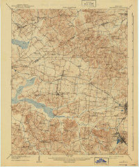
~ Earlington KY topo map, 1:62500 scale, 15 X 15 Minute, Historical, 1909, updated 1940
Earlington, Kentucky, USGS topographic map dated 1909.
Includes geographic coordinates (latitude and longitude). This topographic map is suitable for hiking, camping, and exploring, or framing it as a wall map.
Printed on-demand using high resolution imagery, on heavy weight and acid free paper, or alternatively on a variety of synthetic materials.
Topos available on paper, Waterproof, Poly, or Tyvek. Usually shipping rolled, unless combined with other folded maps in one order.
- Product Number: USGS-5294362
- Free digital map download (high-resolution, GeoPDF): Earlington, Kentucky (file size: 7 MB)
- Map Size: please refer to the dimensions of the GeoPDF map above
- Weight (paper map): ca. 55 grams
- Map Type: POD USGS Topographic Map
- Map Series: HTMC
- Map Verison: Historical
- Cell ID: 53681
- Scan ID: 803478
- Imprint Year: 1940
- Survey Year: 1907
- Datum: Unstated
- Map Projection: Polyconic
- Map published by United States Geological Survey
- Map Language: English
- Scanner Resolution: 508 dpi
- Map Cell Name: Earlington
- Grid size: 15 X 15 Minute
- Date on map: 1909
- Map Scale: 1:62500
- Geographical region: Kentucky, United States
Neighboring Maps:
All neighboring USGS topo maps are available for sale online at a variety of scales.
Spatial coverage:
Topo map Earlington, Kentucky, covers the geographical area associated the following places:
- Rabbit Ridge - Lisman - Brentwood - Oakliff Store (historical) - Colitown Junction - Veazey - Beulah - Wesco - Dozier Heights - Earlington - Victoria - Nebo - Manitou - Sixth Vein - Fiddle Bow - Pee Vee - Hecla - Richland - Oriole - Mitchell Hill - Coiltown - West Hanson - West Side Heights - Oakley Home (historical) - Stanhope - Jolly - Yarbro - Vanderburg - Slaughters - Johnson Island (historical) - Pleasant View (historical)
- Map Area ID: AREA37.537.25-87.75-87.5
- Northwest corner Lat/Long code: USGSNW37.5-87.75
- Northeast corner Lat/Long code: USGSNE37.5-87.5
- Southwest corner Lat/Long code: USGSSW37.25-87.75
- Southeast corner Lat/Long code: USGSSE37.25-87.5
- Northern map edge Latitude: 37.5
- Southern map edge Latitude: 37.25
- Western map edge Longitude: -87.75
- Eastern map edge Longitude: -87.5


