
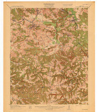
~ Drakesboro KY topo map, 1:62500 scale, 15 X 15 Minute, Historical, 1913
Drakesboro, Kentucky, USGS topographic map dated 1913.
Includes geographic coordinates (latitude and longitude). This topographic map is suitable for hiking, camping, and exploring, or framing it as a wall map.
Printed on-demand using high resolution imagery, on heavy weight and acid free paper, or alternatively on a variety of synthetic materials.
Topos available on paper, Waterproof, Poly, or Tyvek. Usually shipping rolled, unless combined with other folded maps in one order.
- Product Number: USGS-5294350
- Free digital map download (high-resolution, GeoPDF): Drakesboro, Kentucky (file size: 7 MB)
- Map Size: please refer to the dimensions of the GeoPDF map above
- Weight (paper map): ca. 55 grams
- Map Type: POD USGS Topographic Map
- Map Series: HTMC
- Map Verison: Historical
- Cell ID: 53545
- Scan ID: 708548
- Woodland Tint: Yes
- Survey Year: 1911
- Datum: Unstated
- Map Projection: Unstated
- Map published by United States Geological Survey
- Map Language: English
- Scanner Resolution: 508 dpi
- Map Cell Name: Drakesboro
- Grid size: 15 X 15 Minute
- Date on map: 1913
- Map Scale: 1:62500
- Geographical region: Kentucky, United States
Neighboring Maps:
All neighboring USGS topo maps are available for sale online at a variety of scales.
Spatial coverage:
Topo map Drakesboro, Kentucky, covers the geographical area associated the following places:
- Rosewood - Sunrise (historical) - Wells - Greenville - Browder - Deer Lick - Whispering Pines - Agnes - Hillside - Tyewhoppety - Nebo - Drakesboro - Jernigan Chapel (historical) - Depoy - Sharon (historical) - Ebenezer - Little Mountain (historical) - Belton - Nonnell - Powderly - Whiskey Bay - Pleasant Hill (historical) - Beech Creek - Luzerne - Bevier - Prospect (historical) - Peanut (historical) - Greenbriar (historical) - Beechmont - Liberty Hill (historical) - Leighs (historical) - Myers Chapel (historical) - Bivins - Bancroft - Elk Valley (historical) - Kirkmansville - Carters Creek (historical) - Weir - Jason - Union Ridge - Mays Store
- Map Area ID: AREA37.2537-87.25-87
- Northwest corner Lat/Long code: USGSNW37.25-87.25
- Northeast corner Lat/Long code: USGSNE37.25-87
- Southwest corner Lat/Long code: USGSSW37-87.25
- Southeast corner Lat/Long code: USGSSE37-87
- Northern map edge Latitude: 37.25
- Southern map edge Latitude: 37
- Western map edge Longitude: -87.25
- Eastern map edge Longitude: -87


