
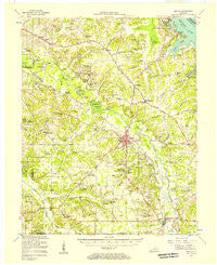
~ Benton KY topo map, 1:62500 scale, 15 X 15 Minute, Historical, 1955, updated 1957
Benton, Kentucky, USGS topographic map dated 1955.
Includes geographic coordinates (latitude and longitude). This topographic map is suitable for hiking, camping, and exploring, or framing it as a wall map.
Printed on-demand using high resolution imagery, on heavy weight and acid free paper, or alternatively on a variety of synthetic materials.
Topos available on paper, Waterproof, Poly, or Tyvek. Usually shipping rolled, unless combined with other folded maps in one order.
- Product Number: USGS-5294266
- Free digital map download (high-resolution, GeoPDF): Benton, Kentucky (file size: 6 MB)
- Map Size: please refer to the dimensions of the GeoPDF map above
- Weight (paper map): ca. 55 grams
- Map Type: POD USGS Topographic Map
- Map Series: HTMC
- Map Verison: Historical
- Cell ID: 51206
- Scan ID: 708152
- Imprint Year: 1957
- Woodland Tint: Yes
- Aerial Photo Year: 1955
- Survey Year: 1955
- Datum: NAD27
- Map Projection: Polyconic
- Map published by United States Geological Survey
- Map Language: English
- Scanner Resolution: 508 dpi
- Map Cell Name: Benton
- Grid size: 15 X 15 Minute
- Date on map: 1955
- Map Scale: 1:62500
- Geographical region: Kentucky, United States
Neighboring Maps:
All neighboring USGS topo maps are available for sale online at a variety of scales.
Spatial coverage:
Topo map Benton, Kentucky, covers the geographical area associated the following places:
- Benton - Jackson (historical) - Harris Hill Ford - Rudolph - Hamlet (historical) - Draffenville - Draffenville - Scale - Hardin - Union Hill (historical) - Oak Level - Dogtown - Bethel - Locust Grove (historical) - Graves County Line - Bryans Ford - Palma - Elva - Walnut Grove - Liberty (historical) - South Marshall - Monkey Den (historical) - Pugh (historical) - Lone Valley (historical) - Harvey - Tatumsville - Olive - Middle Fork (historical) - Joppa - Vanzora (historical) - Yancy Darnell (historical) - Woodall (historical) - Briensburg - Pleasant Valley (historical) - Sharpe - Iola - Jett (historical) - Glade - Griggstown (historical) - Brewers
- Map Area ID: AREA3736.75-88.5-88.25
- Northwest corner Lat/Long code: USGSNW37-88.5
- Northeast corner Lat/Long code: USGSNE37-88.25
- Southwest corner Lat/Long code: USGSSW36.75-88.5
- Southeast corner Lat/Long code: USGSSE36.75-88.25
- Northern map edge Latitude: 37
- Southern map edge Latitude: 36.75
- Western map edge Longitude: -88.5
- Eastern map edge Longitude: -88.25


