
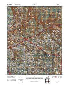
~ Anchorage KY topo map, 1:24000 scale, 7.5 X 7.5 Minute, Historical, 2010
Anchorage, Kentucky, USGS topographic map dated 2010.
Includes geographic coordinates (latitude and longitude). This topographic map is suitable for hiking, camping, and exploring, or framing it as a wall map.
Printed on-demand using high resolution imagery, on heavy weight and acid free paper, or alternatively on a variety of synthetic materials.
Topos available on paper, Waterproof, Poly, or Tyvek. Usually shipping rolled, unless combined with other folded maps in one order.
- Product Number: USGS-5147399
- Free digital map download (high-resolution, GeoPDF): Anchorage, Kentucky (file size: 23 MB)
- Map Size: please refer to the dimensions of the GeoPDF map above
- Weight (paper map): ca. 55 grams
- Map Type: POD USGS Topographic Map
- Map Series: US Topo
- Map Verison: Historical
- Cell ID: 936
- Datum: North American Datum of 1983
- Map Projection: Transverse Mercator
- Map Cell Name: Anchorage
- Grid size: 7.5 X 7.5 Minute
- Date on map: 2010
- Map Scale: 1:24000
- Geographical region: Kentucky, United States
Neighboring Maps:
All neighboring USGS topo maps are available for sale online at a variety of scales.
Spatial coverage:
Topo map Anchorage, Kentucky, covers the geographical area associated the following places:
- Broeck Pointe - Green Spring - Whipps Millgate - Old Brownsboro Place - Hickory Hill - Manor Creek - Rolling Hills - Westwood - Brownsboro Farm - Meadowbrook Farm - Coldstream - Moorland - Springdale - Hills and Dales - O'Bannon - Creekside - Spring Valley - Langdon Place - Lake Louisvilla - Anchorage - Freys Hill - Lyndon - Griffytown - Norwood - Graymoor-Devondale - Worthington - Fraziertown - Bellemeade - Hillcrest - Ballardsville - Lakeland - River Bluff - Prospect - Orchard Grass Hills - Keeneland - Barbourmeade - Ten Broeck - Briarwood - Murray Hill - Worthington Hills - Warwick Villa - Fincastle - Bancroft - Meadow Vale - Plantation - Berrytown
- Map Area ID: AREA38.37538.25-85.625-85.5
- Northwest corner Lat/Long code: USGSNW38.375-85.625
- Northeast corner Lat/Long code: USGSNE38.375-85.5
- Southwest corner Lat/Long code: USGSSW38.25-85.625
- Southeast corner Lat/Long code: USGSSE38.25-85.5
- Northern map edge Latitude: 38.375
- Southern map edge Latitude: 38.25
- Western map edge Longitude: -85.625
- Eastern map edge Longitude: -85.5


