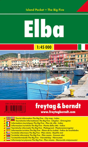
Elba : island pocket + the big five
Map of Elba, with contours at 25m intervals and some additional hill shading to help represent the relief. Main and local roads are shown, with driving distances marked, and hiking paths are clearly shown in red. Compared to the map published by Kompass, there is no offshore detail on this map, slightly less minor road detail and fewer symbols used to denote landmarks & tourist information etc.
The symbols present show chairlifts, harbours & ferry ports, churches, castles & ruins, museums, campsites & spas. Theres also an extra symbol appearing all over the map but omitted from the legend... it seems to indicate baths or bathing beaches.
An inset shows a very simple map of Isola di Montecristo.
No index.
- Product Number: FB_ELBA_PKT_15
- Reference Product Number: 2248437M
- ISBN: 9783707915488
- Date of Publication: 6/1/2015
- Folded Size: 5.91 inches high by 3.54 inches wide
- Unfolded (flat) Size: 31.89 inches high by 17.72 inches wide
- Map format: Folded
- Map type: Trade Maps - Travel
- Geographical region: Italy