
~ Dubuque IA topo map, 1:250000 scale, 1 X 2 Degree, Historical, 1962, updated 1962
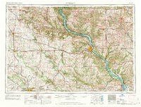
Dubuque, Iowa, USGS topographic map dated 1962.
Includes geographic coordinates (latitude and longitude). This topographic map is suitable for hiking, camping, and exploring, or framing it as a wall map.
Printed on-demand using high resolution imagery, on heavy weight and acid free paper, or alternatively on a variety of synthetic materials.
Topos available on paper, Waterproof, Poly, or Tyvek. Usually shipping rolled, unless combined with other folded maps in one order.
- Product Number: USGS-5283835
- Free digital map download (high-resolution, GeoPDF): Dubuque, Iowa (file size: 17 MB)
- Map Size: please refer to the dimensions of the GeoPDF map above
- Weight (paper map): ca. 55 grams
- Map Type: POD USGS Topographic Map
- Map Series: HTMC
- Map Verison: Historical
- Cell ID: 68757
- Scan ID: 174550
- Imprint Year: 1962
- Woodland Tint: Yes
- Visual Version Number: 2
- Field Check Year: 1958
- Datum: Unstated
- Map Projection: Transverse Mercator
- Map published by United States Geological Survey
- Map published by United States Army Corps of Engineers
- Map published by United States Army
- Map Language: English
- Scanner Resolution: 600 dpi
- Map Cell Name: Dubuque
- Grid size: 1 X 2 Degree
- Date on map: 1962
- Map Scale: 1:250000
- Geographical region: Iowa, United States
Neighboring Maps:
All neighboring USGS topo maps are available for sale online at a variety of scales.
Spatial coverage:
Topo map Dubuque, Iowa, covers the geographical area associated the following places:
- North Andover - Rockdale - Lead Mine - Graf - Massey - Leslie - Louisburg - Lore - Dales Ford - Reeceville - Hanover - Vista - Millbrig (historical) - Sand Springs - Dunbarton - Rowley - Linn Junction - Kieler - Cass - Cobb - Lafayette - Preston - Independence - Bellevue - York - North Bellevue - Bridgeport - Quasqueton - Center Point - White Oak - Wacker - Mederville - Argo Fay - Shady Dell - Volga - Shellsburg - Twin T Mobile Home Park - Bremen - Waubeek - Hazleton - Pleasant Hill (historical) - Union - Lore Mobile Home Park - East Monticello - Brodtville - Washington Mills - Newport - Galena Junction - Buck Creek - Burton - Andrew - Midway - Martelle - Rice - Elkader - Pleasant Creek - Savanna - Five Seasons Manufactured Home Community - Elizabeth - Pleasant Grove - Clayton Center - British Hollow - Ryan - Eckards - Saint Rose - Prairie Corners - Coggon - Twin Springs - Glen Haven - Argand - Jackson - Frith Spur - Garber - Viola - Emeline - Scotch Grove - Paris - La Motte - Manchester - Hiawatha - Robins - Bernard - Dubuque - Baldwin - Ellenboro - Canton - Epworth - Riverside - Apple Canyon Lake - Elk Grove - Ipswich - Eden - McGargels Ford - Jamestown - Rickardsville - Jenkinsville - Rockville - Stanley - Fairview - Calamine
- Map Area ID: AREA4342-92-90
- Northwest corner Lat/Long code: USGSNW43-92
- Northeast corner Lat/Long code: USGSNE43-90
- Southwest corner Lat/Long code: USGSSW42-92
- Southeast corner Lat/Long code: USGSSE42-90
- Northern map edge Latitude: 43
- Southern map edge Latitude: 42
- Western map edge Longitude: -92
- Eastern map edge Longitude: -90


