
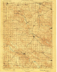
~ Anamosa IA topo map, 1:125000 scale, 30 X 30 Minute, Historical, 1900
Anamosa, Iowa, USGS topographic map dated 1900.
Includes geographic coordinates (latitude and longitude). This topographic map is suitable for hiking, camping, and exploring, or framing it as a wall map.
Printed on-demand using high resolution imagery, on heavy weight and acid free paper, or alternatively on a variety of synthetic materials.
Topos available on paper, Waterproof, Poly, or Tyvek. Usually shipping rolled, unless combined with other folded maps in one order.
- Product Number: USGS-5283743
- Free digital map download (high-resolution, GeoPDF): Anamosa, Iowa (file size: 8 MB)
- Map Size: please refer to the dimensions of the GeoPDF map above
- Weight (paper map): ca. 55 grams
- Map Type: POD USGS Topographic Map
- Map Series: HTMC
- Map Verison: Historical
- Cell ID: 65465
- Scan ID: 174070
- Visual Version Number: 1
- Survey Year: 1896
- Datum: Unstated
- Map Projection: Unstated
- Map published by United States Geological Survey
- Keywords: Nonstandard Press Run
- Map Language: English
- Scanner Resolution: 600 dpi
- Map Cell Name: Farley
- Grid size: 30 X 30 Minute
- Date on map: 1900
- Map Scale: 1:125000
- Geographical region: Iowa, United States
Neighboring Maps:
All neighboring USGS topo maps are available for sale online at a variety of scales.
Spatial coverage:
Topo map Anamosa, Iowa, covers the geographical area associated the following places:
- East Monticello - Buck Creek - Waubeek - Delhi - Springhole - Wyoming - Fairview - Newport - Edinburg - Manchester - Farley - Amber - Hazel Green - Junction Switch - Center Junction - Rockville - Downers Grove - Dyersville - Jordans Grove - Golden - Prairieburg - Langworthy - Paralta - Earlville - Cass - Castle Grove - Mekee - Monticello - Johnson (historical) - Cascade - Scotch Grove - Jackson - Onslow - Anamosa - Ryan - Orchard Lane Mobile Home Court - Argand - Stone City - Worthington - Hale - Paris (historical) - Carlton Mobile Home Court - Whittier - Northwind Mobile Home Park - Gilt Edge - Morley - Viola - Martelle - Springville - Sand Springs - Hopkinton - Dales Ford - Delaware - Ebys Mill - Summit Village Dyersville Park
- Map Area ID: AREA42.542-91.5-91
- Northwest corner Lat/Long code: USGSNW42.5-91.5
- Northeast corner Lat/Long code: USGSNE42.5-91
- Southwest corner Lat/Long code: USGSSW42-91.5
- Southeast corner Lat/Long code: USGSSE42-91
- Northern map edge Latitude: 42.5
- Southern map edge Latitude: 42
- Western map edge Longitude: -91.5
- Eastern map edge Longitude: -91


