
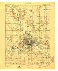
~ Des Moines IA topo map, 1:62500 scale, 15 X 15 Minute, Historical, 1907
Des Moines, Iowa, USGS topographic map dated 1907.
Includes geographic coordinates (latitude and longitude). This topographic map is suitable for hiking, camping, and exploring, or framing it as a wall map.
Printed on-demand using high resolution imagery, on heavy weight and acid free paper, or alternatively on a variety of synthetic materials.
Topos available on paper, Waterproof, Poly, or Tyvek. Usually shipping rolled, unless combined with other folded maps in one order.
- Product Number: USGS-5283357
- Free digital map download (high-resolution, GeoPDF): Des Moines, Iowa (file size: 7 MB)
- Map Size: please refer to the dimensions of the GeoPDF map above
- Weight (paper map): ca. 55 grams
- Map Type: POD USGS Topographic Map
- Map Series: HTMC
- Map Verison: Historical
- Cell ID: 53374
- Scan ID: 174500
- Survey Year: 1905
- Datum: Unstated
- Map Projection: Unstated
- Map published by United States Geological Survey
- Keywords: Nonstandard Press Run
- Map Language: English
- Scanner Resolution: 600 dpi
- Map Cell Name: Des Moines
- Grid size: 15 X 15 Minute
- Date on map: 1907
- Map Scale: 1:62500
- Geographical region: Iowa, United States
Neighboring Maps:
All neighboring USGS topo maps are available for sale online at a variety of scales.
Spatial coverage:
Topo map Des Moines, Iowa, covers the geographical area associated the following places:
- Ankeny - Herrold - Radio City Mobile Home Park - Camp Dodge - Carbondale - West Des Moines - South Ridge Estates - Blue Bird Mobile Park - Corydon (historical) - Bowsher - White Oak - Oralabor - Pleasant Valley Mobile Home Park - Avon - Berwick - Sunny-Brook Mobile Home Park - Saylor - Crestwood - Millman - Quilhart (historical) - Rocklyn Mobile Home - Carney - East Des Moines - Johnston - Country Estate Village - Saylor Station - Norwoodville - Avon Lake - Stover Heights Community - Swanwood - Levey - P and H Mobile Home Court - Paradise Mobile Home Park - Lakewood - Valley Junction - Capitol Heights - Highview Mobile Home Park - Grandview Village Mobile Home Park - Urbandale - Pleasant Hill - Western Village Mobile Home Park - Des Moines - Oakwood Heights Mobile Home Park - Marquisville - Andrew Mobile Home Park - Easton Place - Country Living Mobile Home Park - Pine Grove Mobile Home Park - Lovington - Mel-Ray Mobile Home Park - Regency Manor Mobile Home Park - Fort Des Moines - Windsor Heights - Orilla - Clive - Saylorville - The Meadows - Enterprise
- Map Area ID: AREA41.7541.5-93.75-93.5
- Northwest corner Lat/Long code: USGSNW41.75-93.75
- Northeast corner Lat/Long code: USGSNE41.75-93.5
- Southwest corner Lat/Long code: USGSSW41.5-93.75
- Southeast corner Lat/Long code: USGSSE41.5-93.5
- Northern map edge Latitude: 41.75
- Southern map edge Latitude: 41.5
- Western map edge Longitude: -93.75
- Eastern map edge Longitude: -93.5


