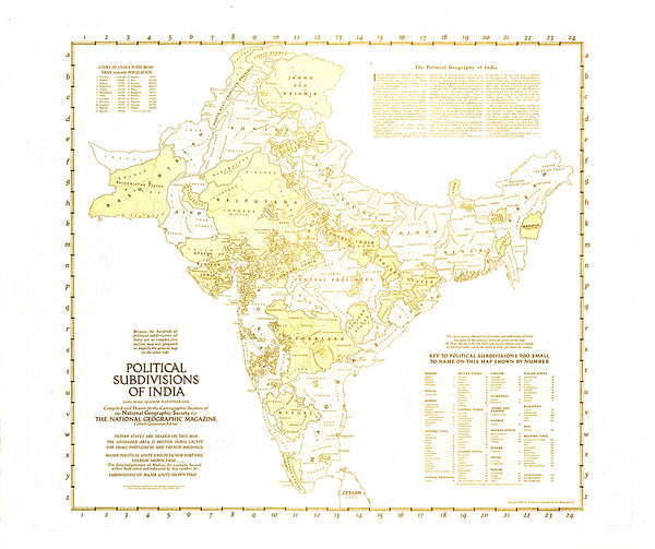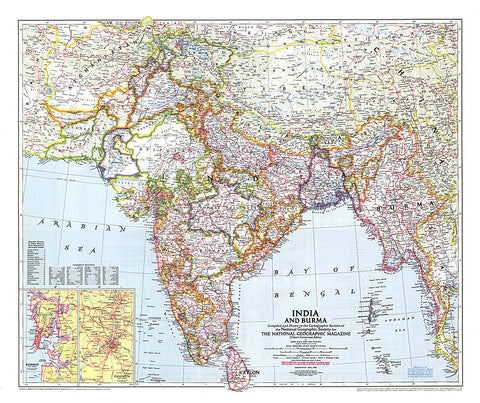
1946 India and Burma Map
Published in April 1946 just a year before India and Pakistan gained their independence, this map of India and Burma details the numerous provinces of the region. Half of a two-map set, it accompanied the Political Subdivisions of India map and three articles on India.
- Product Number: PODHNG_IND_BUR_46
- Reference Product Number: 2321362M
- ISBN: - None -
- Date of Publication: 6/1/1946
- Unfolded (flat) Size: 26 inches high by 31 inches wide
- Map format: Wall
- Map type: Trade Maps - Political
- Geographical region: India,Myanmar (Burma)