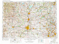
~ Rockford IL topo map, 1:250000 scale, 1 X 2 Degree, Historical, 1958, updated 1974
Rockford, Illinois, USGS topographic map dated 1958.
Includes geographic coordinates (latitude and longitude). This topographic map is suitable for hiking, camping, and exploring, or framing it as a wall map.
Printed on-demand using high resolution imagery, on heavy weight and acid free paper, or alternatively on a variety of synthetic materials.
Topos available on paper, Waterproof, Poly, or Tyvek. Usually shipping rolled, unless combined with other folded maps in one order.
- Product Number: USGS-5532963
- Free digital map download (high-resolution, GeoPDF): Rockford, Illinois (file size: 23 MB)
- Map Size: please refer to the dimensions of the GeoPDF map above
- Weight (paper map): ca. 55 grams
- Map Type: POD USGS Topographic Map
- Map Series: HTMC
- Map Verison: Historical
- Cell ID: 68990
- Scan ID: 310182
- Imprint Year: 1974
- Woodland Tint: Yes
- Aerial Photo Year: 1968
- Edit Year: 1971
- Datum: Unstated
- Map Projection: Transverse Mercator
- Map published by United States Army Corps of Engineers
- Map published by United States Army
- Map Language: English
- Scanner Resolution: 600 dpi
- Map Cell Name: Rockford
- Grid size: 1 X 2 Degree
- Date on map: 1958
- Map Scale: 1:250000
- Geographical region: Illinois, United States
Neighboring Maps:
All neighboring USGS topo maps are available for sale online at a variety of scales.
Spatial coverage:
Topo map Rockford, Illinois, covers the geographical area associated the following places:
- Solon Mills - Johnsburg - Coyne - Forreston - Ross Crossing - Old Mill Grove - Long Lake - Dodges Corners (historical) - Morristown - Albany - Nora - Nottingham Manor - Edgerton Beach Park - Whitewater - Tichigan - Hanerville - Mylith Park - Magnolia - Hickory View Estates - Lake Zurich Highlands - Rutland - Orangeville - Exeter - Koshkonong Mounds - Moscow - Petty Acres - Tiffany - Thorne Ledge - Capron - Lonesome Acres - Kishwaukee Glen - Afolkey - West Junction - Hickory Hills - Beiler Subdivision - Lilymoor - Lake Barrington - Honey Creek - Utica - Orfordville - Hillside - Belcrest - River Forest - Milton Junction - Garden Grove Mobile Home Park - Cooksville - Genesee - Cainville - Wonder Center - Bridlewoods - Lorimar Estates - Lawrence - Ottawa - Indianford - Lakeview - Green View Heights - Indian Trails - Clare - Von Glen Acres - Amherst - Stephenson Mobile Home Estates - Glen Oaks Estates - Ravens Wing - Williamsburg - Oak Ridge North - Kishwaukee - Woodruff Corners - Knollwood Estates Mobile Home Park - Schultz - Trout Valley - Foxcroft - Colvin Park - Cedar Park - Durham - Epplyanna - Antioch - Lake Geneva - Swansway - Greenridge Estates - Pine Valley - Esmond - Fort Hill - Southside Mobile Home Park - Wempletown - Maple Beach - Canyon Ridge - New Berlin - Rue Vallee - Woodcrest - Trevor - Harrison Avenue Gardens - Hartland - Basco - Cedarville - Brooklyn - Woodworth - Tall Trees - Rosewood - Tamara Heights - Family Manufactured Home Community
- Map Area ID: AREA4342-90-88
- Northwest corner Lat/Long code: USGSNW43-90
- Northeast corner Lat/Long code: USGSNE43-88
- Southwest corner Lat/Long code: USGSSW42-90
- Southeast corner Lat/Long code: USGSSE42-88
- Northern map edge Latitude: 43
- Southern map edge Latitude: 42
- Western map edge Longitude: -90
- Eastern map edge Longitude: -88

