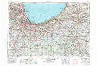
~ Chicago IL topo map, 1:250000 scale, 1 X 2 Degree, Historical, 1953, updated 1984
Chicago, Illinois, USGS topographic map dated 1953.
Includes geographic coordinates (latitude and longitude). This topographic map is suitable for hiking, camping, and exploring, or framing it as a wall map.
Printed on-demand using high resolution imagery, on heavy weight and acid free paper, or alternatively on a variety of synthetic materials.
Topos available on paper, Waterproof, Poly, or Tyvek. Usually shipping rolled, unless combined with other folded maps in one order.
- Product Number: USGS-5532917
- Free digital map download (high-resolution, GeoPDF): Chicago, Illinois (file size: 25 MB)
- Map Size: please refer to the dimensions of the GeoPDF map above
- Weight (paper map): ca. 55 grams
- Map Type: POD USGS Topographic Map
- Map Series: HTMC
- Map Verison: Historical
- Cell ID: 68714
- Scan ID: 310156
- Imprint Year: 1984
- Woodland Tint: Yes
- Aerial Photo Year: 1979
- Edit Year: 1983
- Field Check Year: 1953
- Datum: NAD27
- Map Projection: Transverse Mercator
- Map published by United States Geological Survey
- Map Language: English
- Scanner Resolution: 600 dpi
- Map Cell Name: Chicago
- Grid size: 1 X 2 Degree
- Date on map: 1953
- Map Scale: 1:250000
- Geographical region: Illinois, United States
Neighboring Maps:
All neighboring USGS topo maps are available for sale online at a variety of scales.
Spatial coverage:
Topo map Chicago, Illinois, covers the geographical area associated the following places:
- Collins (historical) - Indian Oaks - Babcock - Turkey Creek Meadows - Lincoln Square (historical) - Gorman Farm - Clarkdale - South Wanatah - IXL Mobile Home Park - Maxinkuckee - Whiskey Point - Ridge Road Mobile Home Community - Mallard Lake Estates - Saint Anne - Crawford - South Kenwood - Pierces Park - Ainsworth - South Lynn - Drexel Estate - Beverly - Chatham - Jackson Park Highlands - Holbrook - Georgetown - Ogden Dunes - Ridgeland Lakes Estates - Leroy - West Town - Monroe Manor - Pine Hills Estates - Walkerton - Irwin - Bremerton Mobile Home Park - Edgetown - Robert Taylor Homes (historical) - Hubbard - Farm View Hills - North Liberty - Hawthorne Hills - New Troy - Franklin Park - Oakwood - Haskell - Birchim - Saint John - Moreland - Pheasant Hollow N - Aldine - Bremen - Goeselville - Pershing - Garibaldi Square - Phoenix - Ironworkers Addition to South Chicago - Lake Hills - Nearwest Side - Sag Bridge - Indian Head Park - Darien - Baileys Corner - Hartsdale - Hebron - Hillcrest - Montrose - Edwardsburg Mobile Home Estates - Pleasant Valley - New Elliott - Palmer - Norridge - Wheatfield - Brookdale - Gifford - Lowell - Greenwich - Twin Creek - Koster - North Hayden - Addison - Humboldt - Deselm - South Holland - Tefft - Heatherbrook Estates - Deer Creek - Gary - Litchfield - Harris - Lake Park - South Center - Marquette Manor - Garden Homes - West Elsdon - Robert Brooks Homes - Gates Corner - Colonial Gardens - Homewood - Woodland Village - Palos Hills - Hurlburt
- Map Area ID: AREA4241-88-86
- Northwest corner Lat/Long code: USGSNW42-88
- Northeast corner Lat/Long code: USGSNE42-86
- Southwest corner Lat/Long code: USGSSW41-88
- Southeast corner Lat/Long code: USGSSE41-86
- Northern map edge Latitude: 42
- Southern map edge Latitude: 41
- Western map edge Longitude: -88
- Eastern map edge Longitude: -86

