
Illinois, Physical, Laminated Wall Map by Raven Maps
Detailed physical wall map of Illinois State at a scale of 1:500,000. Laminated.
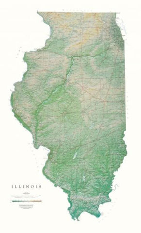
The cartography shows relief through a stunning, highly detailed shading, with different elevations varying in color, giving an almost 3-dimensional feel to the map. Peak heights are also clearly marked.
The map displays land only within the boundaries of the chosen states - there is no overlap with neighboring states. Principal physical features such as glaciers, mountain ranges, rivers and lakes are shown clearly. Human features, such as main towns, cities, roads and railways, are shown in a very fine, subtle and elegant cartographic style. State capitals are also clearly marked.
This map measures 140 x 84cm (55 x 33). This Illinois map beautifully displays the delicate landscape. From Lake Michigan to the Ohio and Mississippi Rivers, the valleys, plains, rivers, and prairies are exquisitely mapped in shades of greens and light browns.
- Product Number: 2030664M
- Product Code: RP_IL_LA
- ISBN: 9780783425566
- Year of Publication: 1998
- Map type: Wall Map
- Geographical region: Illinois


