
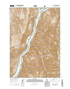
~ Sturgill Creek ID topo map, 1:24000 scale, 7.5 X 7.5 Minute, Current, 2013
Sturgill Creek, Idaho, USGS topographic map dated 2013.
Includes geographic coordinates (latitude and longitude). This topographic map is suitable for hiking, camping, and exploring, or framing it as a wall map.
Printed on-demand using high resolution imagery, on heavy weight and acid free paper, or alternatively on a variety of synthetic materials.
Topos available on paper, Waterproof, Poly, or Tyvek. Usually shipping rolled, unless combined with other folded maps in one order.
- Product Number: USGS-7753676
- Free digital map download (high-resolution, GeoPDF): Sturgill Creek, Idaho (file size: 29 MB)
- Map Size: please refer to the dimensions of the GeoPDF map above
- Weight (paper map): ca. 55 grams
- Map Type: POD USGS Topographic Map
- Map Series: US Topo
- Map Verison: Current
- Cell ID: 43563
- Datum: North American Datum of 1983
- Map Projection: Transverse Mercator
- Map Cell Name: Sturgill Creek
- Grid size: 7.5 X 7.5 Minute
- Date on map: 2013
- Map Scale: 1:24000
- Geographical region: Idaho, United States
Neighboring Maps:
All neighboring USGS topo maps are available for sale online at a variety of scales.
Spatial coverage:
Topo map Sturgill Creek, Idaho, covers the geographical area associated the following places:
- Quicksand Creek - Skookum Chuck Creek - Lick Creek - Andrew Spring - Sheep Creek - Middle Long Hollow - Deer Gulch - Quartz Gulch - Lone Pine Gulch - Cable Ferry - Benton Creek - Sturgill Rapids (historical) - Haystack Gulch - Jackson Gulch - Sturgill (historical) - Powder River - Garden Gulch - Reservoir Gulch - Olden Post Office (historical) - Coyote Flat - Brownlee Reservoir - Titus (historical) - Canyon Creek - Swedes Landing (historical) - Flickbar Post Office (historical) - Corral Gulch - Sturgill Creek - Limestone Gulch - Swede's Landing Boat Launch
- Map Area ID: AREA44.7544.625-117.125-117
- Northwest corner Lat/Long code: USGSNW44.75-117.125
- Northeast corner Lat/Long code: USGSNE44.75-117
- Southwest corner Lat/Long code: USGSSW44.625-117.125
- Southeast corner Lat/Long code: USGSSE44.625-117
- Northern map edge Latitude: 44.75
- Southern map edge Latitude: 44.625
- Western map edge Longitude: -117.125
- Eastern map edge Longitude: -117


