
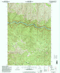
~ Stillman Point ID topo map, 1:24000 scale, 7.5 X 7.5 Minute, Historical, 1995, updated 1999
Stillman Point, Idaho, USGS topographic map dated 1995.
Includes geographic coordinates (latitude and longitude). This topographic map is suitable for hiking, camping, and exploring, or framing it as a wall map.
Printed on-demand using high resolution imagery, on heavy weight and acid free paper, or alternatively on a variety of synthetic materials.
Topos available on paper, Waterproof, Poly, or Tyvek. Usually shipping rolled, unless combined with other folded maps in one order.
- Product Number: USGS-5435667
- Free digital map download (high-resolution, GeoPDF): Stillman Point, Idaho (file size: 19 MB)
- Map Size: please refer to the dimensions of the GeoPDF map above
- Weight (paper map): ca. 55 grams
- Map Type: POD USGS Topographic Map
- Map Series: HTMC
- Map Verison: Historical
- Cell ID: 43207
- Scan ID: 238331
- Imprint Year: 1999
- Woodland Tint: Yes
- Aerial Photo Year: 1992
- Field Check Year: 1995
- Datum: NAD27
- Map Projection: Transverse Mercator
- Map published by United States Geological Survey
- Map published by United States Forest Service
- Map Language: English
- Scanner Resolution: 600 dpi
- Map Cell Name: Stillman Point
- Grid size: 7.5 X 7.5 Minute
- Date on map: 1995
- Map Scale: 1:24000
- Geographical region: Idaho, United States
Neighboring Maps:
All neighboring USGS topo maps are available for sale online at a variety of scales.
Spatial coverage:
Topo map Stillman Point, Idaho, covers the geographical area associated the following places:
- Slide Creek - Boyd Creek Campground - Saddle Ridge - Fern Creek - Nineteenmile Creek - Dave Creek - Cache Creek - Twentythree Mile Creek - Twentyfive Mile Bar - Rackliff Campground - Boyd Creek - Stillman Point - Rackliff Creek - Twentythree Mile Campground - Island Creek - Wash Creek - O'Hara Point - Rock Island - Sob Point - Twentymile Bar - Twentymile Bar Campground - Slide Creek Campground
- Map Area ID: AREA46.12546-115.5-115.375
- Northwest corner Lat/Long code: USGSNW46.125-115.5
- Northeast corner Lat/Long code: USGSNE46.125-115.375
- Southwest corner Lat/Long code: USGSSW46-115.5
- Southeast corner Lat/Long code: USGSSE46-115.375
- Northern map edge Latitude: 46.125
- Southern map edge Latitude: 46
- Western map edge Longitude: -115.5
- Eastern map edge Longitude: -115.375


