
~ Spades Mountain ID topo map, 1:24000 scale, 7.5 X 7.5 Minute, Historical, 1996, updated 1999
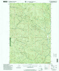
Spades Mountain, Idaho, USGS topographic map dated 1996.
Includes geographic coordinates (latitude and longitude). This topographic map is suitable for hiking, camping, and exploring, or framing it as a wall map.
Printed on-demand using high resolution imagery, on heavy weight and acid free paper, or alternatively on a variety of synthetic materials.
Topos available on paper, Waterproof, Poly, or Tyvek. Usually shipping rolled, unless combined with other folded maps in one order.
- Product Number: USGS-5435521
- Free digital map download (high-resolution, GeoPDF): Spades Mountain, Idaho (file size: 17 MB)
- Map Size: please refer to the dimensions of the GeoPDF map above
- Weight (paper map): ca. 55 grams
- Map Type: POD USGS Topographic Map
- Map Series: HTMC
- Map Verison: Historical
- Cell ID: 42376
- Scan ID: 238238
- Imprint Year: 1999
- Woodland Tint: Yes
- Aerial Photo Year: 1987
- Field Check Year: 1996
- Datum: NAD27
- Map Projection: Transverse Mercator
- Map published by United States Geological Survey
- Map published by United States Forest Service
- Map Language: English
- Scanner Resolution: 600 dpi
- Map Cell Name: Spades Mountain
- Grid size: 7.5 X 7.5 Minute
- Date on map: 1996
- Map Scale: 1:24000
- Geographical region: Idaho, United States
Neighboring Maps:
All neighboring USGS topo maps are available for sale online at a variety of scales.
Spatial coverage:
Topo map Spades Mountain, Idaho, covers the geographical area associated the following places:
- Deerfoot Ridge - Straight Creek - Badger Mountain - Two Forks Creek - Bradbury Mine - Hudlow Saddle - Hamburg Creek - Barney Creek - Lost Mine Creek - Iron Creek - Lone Cabin Creek - Ulrich Creek - Half Mile Creek - Canyon Fork - Ridge Creek - Burnt Cabin Summit - Spades Mountain - Beaver Creek - Corner Creek - Conie Creek - Buckles Mountain - Cathcart Creek - Pyrite Creek - Chilco Creek - Lewelling Creek - Little Creek - South Chilco Mountain - Three Forks Creek - Bottom Creek - Nicholas Creek - Tenderfoot Ridge - West Fork Hudlow Creek - Squirrel Creek - Dandy Mine - Hells Canyon - Sage Creek Saddle - Hudlow Camp - East Fork Hudlow Creek - Burnt Cabin Mine - Hudlow Creek - George Creek - Todd Creek - Middle Fork Hudlow Creek
- Map Area ID: AREA47.87547.75-116.625-116.5
- Northwest corner Lat/Long code: USGSNW47.875-116.625
- Northeast corner Lat/Long code: USGSNE47.875-116.5
- Southwest corner Lat/Long code: USGSSW47.75-116.625
- Southeast corner Lat/Long code: USGSSE47.75-116.5
- Northern map edge Latitude: 47.875
- Southern map edge Latitude: 47.75
- Western map edge Longitude: -116.625
- Eastern map edge Longitude: -116.5


