
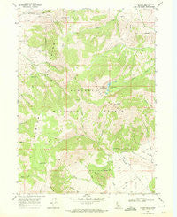
~ Cache Peak ID topo map, 1:24000 scale, 7.5 X 7.5 Minute, Historical, 1968, updated 1972
Cache Peak, Idaho, USGS topographic map dated 1968.
Includes geographic coordinates (latitude and longitude). This topographic map is suitable for hiking, camping, and exploring, or framing it as a wall map.
Printed on-demand using high resolution imagery, on heavy weight and acid free paper, or alternatively on a variety of synthetic materials.
Topos available on paper, Waterproof, Poly, or Tyvek. Usually shipping rolled, unless combined with other folded maps in one order.
- Product Number: USGS-5431022
- Free digital map download (high-resolution, GeoPDF): Cache Peak, Idaho (file size: 12 MB)
- Map Size: please refer to the dimensions of the GeoPDF map above
- Weight (paper map): ca. 55 grams
- Map Type: POD USGS Topographic Map
- Map Series: HTMC
- Map Verison: Historical
- Cell ID: 6603
- Scan ID: 235549
- Imprint Year: 1972
- Woodland Tint: Yes
- Aerial Photo Year: 1967
- Field Check Year: 1968
- Datum: NAD27
- Map Projection: Polyconic
- Map published by United States Geological Survey
- Map Language: English
- Scanner Resolution: 600 dpi
- Map Cell Name: Cache Peak
- Grid size: 7.5 X 7.5 Minute
- Date on map: 1968
- Map Scale: 1:24000
- Geographical region: Idaho, United States
Neighboring Maps:
All neighboring USGS topo maps are available for sale online at a variety of scales.
Spatial coverage:
Topo map Cache Peak, Idaho, covers the geographical area associated the following places:
- Basin-Elba Pass - Almo Park - Salt Lick Spring - Slide Canyon - Heath Spring - Mount Independence - Independence Lakes - Logger Spring - Castle Rocks - Spring Canyon - Sanford Spring - Johnson Creek - Black Creek - Independence Mountain - Cold Spring - Heath Creek - Albion Mountains - Cache Peak - Castle Rocks State Park - Myers Canyon - Rangers Trail - Stines Pass - Bull Spring - Aspen Creek - Pot Holes
- Map Area ID: AREA42.2542.125-113.75-113.625
- Northwest corner Lat/Long code: USGSNW42.25-113.75
- Northeast corner Lat/Long code: USGSNE42.25-113.625
- Southwest corner Lat/Long code: USGSSW42.125-113.75
- Southeast corner Lat/Long code: USGSSE42.125-113.625
- Northern map edge Latitude: 42.25
- Southern map edge Latitude: 42.125
- Western map edge Longitude: -113.75
- Eastern map edge Longitude: -113.625


