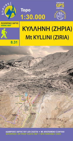
Mt Ziria (1:30 000) Hiking Map
Hiking Map of ?ount Ziria in scale 1:30 000.
Mount Ziria (probably from the slavic word for dawn) or Kilini or Cyllene as it was called in Ancient times, is the second highest mountain in the Peloponnese at 2374 m. Despite its high altitude by Greek mountains standards, it has mild relief and fertile lands. Large plateaus and valleys compose the mountain scenery and below them lie the two large basins of Feneos and Stimfalia, with the homonymous lake.The new Anavasi map, in scale 1:30,000 is double-sided and covers the region around the mountain, starting from the sea, Akrata to Kamari and stretching south to Lafka and Psari.
The variety and beauty of the landscape is unique, maybe because of the harmonious coexistence of nature, myth and history. Discover the mountain mythical dimension in the cave of Hermes or in the gorge of Fonissa with its cavernous gaps and all around you in the beautiful valley of Flampouritsa, the lakes Dasiou and Stymphalia. Learn more about Stym
- Product Number: ANA_ZIRIA_KILLINI_HIKE_16
- Reference Product Number: - None -
- ISBN: 9789609412490
- Date of Publication: 1/1/2016
- Folded Size: 9.75 inches high by 5.25 inches wide
- Unfolded (flat) Size: 38.8 inches high by 26.6 inches wide
- Map format: Folded
- Map type: Trade Maps - Hiking
- Geographical region: Greece