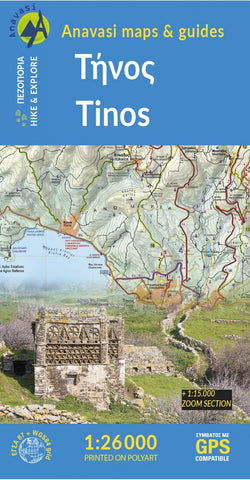
Tinos (1:27 000) Hiking Map
Hiking map of Tinos island in a scale of 1:26.000
Tinos island landscape is like a hand made embroidery. Rural huts, dovecotes, churches, terraces and villages are woven into a net of trails. The new map of Tinos offers a guided tour to the islands man made countryside through a dozen of hiking routes. After several editions of the map and over 450 km of recorded trails, we upgraded the depiction of the island by enlarging the area with the densest network of trails at the scale of 1:15 000.
- Product Number: ANA_TINOS_HIKE_20
- Reference Product Number: - None -
- ISBN: 9789608195998
- Date of Publication: 1/1/2020
- Folded Size: 9 inches high by 5 inches wide
- Unfolded (flat) Size: 38.8 inches high by 26.6 inches wide
- Map format: Folded
- Map type: Trade Maps - Hiking
- Geographical region: Greece

