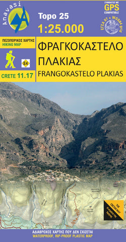
Fragokastelo - Plakias (1:25 000)
Hiking map of Fragkokastelo in a scale of 1:25.000
A new map on the eastern side of the White Mountains, adjacent to the map Sfakia – Pachnes, that extends from the Imbros gorge to the well-known resort of Plakias. On the southern side of this area, facing the Libyan sea, are a series of canyons, starting from the coast and reaching the higher slopes of Mt Angathes and Kryoneritis. A typical landscape of the Sfakia region with rough terrain and rocky, barren slopes. The northern side of these mountains is markedly different, with softer terrain, more vegetation and villages bearing influence of Venetian architecture. Dozens of hiking paths are recorded on the map, mainly in canyons as well as long crossings such as the E4 trail and the new long distance trail the Cretan Way.
Wander- und Straßenkarte von ANAVASI (Crete 11.17) im Maßstab 1 : 25.000.
Auf ihr sind alle großen und kleinen Straßen und Wege der Umgebung eingezeichnet und viele lohnenswerte Ausflüge und
- Product Number: ANA_FRAGOKASTELO_HIKE_19
- Reference Product Number: - None -
- ISBN: 9789609412216
- Date of Publication: 1/1/2019
- Map format: Folded
- Map type: Trade Maps - Hiking
- Geographical region: Greece