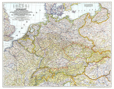
1944 Germany and Its Approaches 1938-1939 Map
A must-have for those interested in World War II, this informative map was published in July 1944 with an article entitled Landing Craft for Invasion. This work shows the international boundaries as of Sept. 1, 1939, the day Germany invaded Poland, and boundaries as of Jan. 1, 1938, before Germany seized Austria and Czechoslovakia.
- Product Number: PODHNG_GER_44
- Reference Product Number: 2321459M
- ISBN: - None -
- Date of Publication: 6/1/1944
- Unfolded (flat) Size: 26.25 inches high by 33.5 inches wide
- Map format: Wall
- Map type: Trade Maps - Historical
- Geographical region: Germany