
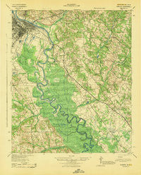
~ Augusta GA topo map, 1:62500 scale, 15 X 15 Minute, Historical, 1943
Augusta, Georgia, USGS topographic map dated 1943.
Includes geographic coordinates (latitude and longitude). This topographic map is suitable for hiking, camping, and exploring, or framing it as a wall map.
Printed on-demand using high resolution imagery, on heavy weight and acid free paper, or alternatively on a variety of synthetic materials.
Topos available on paper, Waterproof, Poly, or Tyvek. Usually shipping rolled, unless combined with other folded maps in one order.
- Product Number: USGS-5388656
- Free digital map download (high-resolution, GeoPDF): Augusta, Georgia (file size: 9 MB)
- Map Size: please refer to the dimensions of the GeoPDF map above
- Weight (paper map): ca. 55 grams
- Map Type: POD USGS Topographic Map
- Map Series: HTMC
- Map Verison: Historical
- Cell ID: 50797
- Scan ID: 261786
- Woodland Tint: Yes
- Aerial Photo Year: 1941
- Survey Year: 1919
- Datum: NAD27
- Map Projection: Polyconic
- Map published by United States Army Corps of Engineers
- Map published by United States Department of War
- Map Language: English
- Scanner Resolution: 600 dpi
- Map Cell Name: Augusta
- Grid size: 15 X 15 Minute
- Date on map: 1943
- Map Scale: 1:62500
- Geographical region: Georgia, United States
Neighboring Maps:
All neighboring USGS topo maps are available for sale online at a variety of scales.
Spatial coverage:
Topo map Augusta, Georgia, covers the geographical area associated the following places:
- Turrin Hill - Cowden - Wood Valley - Westover - Aragon Park - Hankinson - Hyde Park - Summerfields - Carolina Heights - Augusta - Hamburg - Tahoma - Lynns Ranchettes - Eastview - Hollow Creek - Clearwater - Storm Branch Park - Beech Island - Savannah Terrace - Walkinshaw - Grays Landing - Schultz Hill - Sunset Heights - Kathwood - Monticello Estates - Savanna Town (historical) - Mechanic Hill - Jackson - Browns Hill - Johnstown - Mealing Heights - Pembrook - Brigham Woods - Russell Hill - Twiggs - Spiderweb - Bush (historical) - Apple Valley - Gordon Park - Stone Gap - Goshen Plantation - Nixon - Marion Homes
- Map Area ID: AREA33.533.25-82-81.75
- Northwest corner Lat/Long code: USGSNW33.5-82
- Northeast corner Lat/Long code: USGSNE33.5-81.75
- Southwest corner Lat/Long code: USGSSW33.25-82
- Southeast corner Lat/Long code: USGSSE33.25-81.75
- Northern map edge Latitude: 33.5
- Southern map edge Latitude: 33.25
- Western map edge Longitude: -82
- Eastern map edge Longitude: -81.75


