
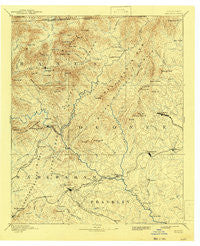
~ Walhalla GA topo map, 1:125000 scale, 30 X 30 Minute, Historical, 1892, updated 1943
Walhalla, Georgia, USGS topographic map dated 1892.
Includes geographic coordinates (latitude and longitude). This topographic map is suitable for hiking, camping, and exploring, or framing it as a wall map.
Printed on-demand using high resolution imagery, on heavy weight and acid free paper, or alternatively on a variety of synthetic materials.
Topos available on paper, Waterproof, Poly, or Tyvek. Usually shipping rolled, unless combined with other folded maps in one order.
- Product Number: USGS-5365324
- Free digital map download (high-resolution, GeoPDF): Walhalla, Georgia (file size: 8 MB)
- Map Size: please refer to the dimensions of the GeoPDF map above
- Weight (paper map): ca. 55 grams
- Map Type: POD USGS Topographic Map
- Map Series: HTMC
- Map Verison: Historical
- Cell ID: 66875
- Scan ID: 247813
- Imprint Year: 1943
- Survey Year: 1885
- Datum: Unstated
- Map Projection: Polyconic
- Map published by United States Geological Survey
- Map Language: English
- Scanner Resolution: 600 dpi
- Map Cell Name: Walhalla
- Grid size: 30 X 30 Minute
- Date on map: 1892
- Map Scale: 1:125000
- Geographical region: Georgia, United States
Neighboring Maps:
All neighboring USGS topo maps are available for sale online at a variety of scales.
Spatial coverage:
Topo map Walhalla, Georgia, covers the geographical area associated the following places:
- Chauga Heights - Carnes Creek - Cheohee - Percival Crossroads - Crystal Falls - Clearmont - Avalon - Poplar Grove - Spring Lake - Richland - Five Points - Ebenezer - Johns Mill - Old Madison - Forest Acres - Oconee Estates - Union Hill - Toccoa Falls - Woodland Trailer Park - Fighting Pine - Tiger - Longcreek - Colonial Heights - Brock - Westminster - Dixon Crossroads - Hollywood - New Switzerland - Tamassee - Long Bottom Ford - Country Villa Subdivision - Dutch Fork - West Union - Burns Mill - Jason - Toccoa - Oakway - Battle Creek - York - Retreat - Antioch - Eastminster - Hayes Crossing - Ayersville - Avondale - Boydville - Tallulah Park (historical) - Eastcliff - Anandale (historical) - Mountain City - Jarrett - Springdale - Eastanollee - Sky Valley - Whetstone - Tabor - Moody Cove - Holly Springs - Three Forks - Phinney - Laurel Falls - Shorts Mill - Madison - Satolah - Lakemont - Walhalla - Brasstown - Hicks Store - Turnerville - Germany - Port Bass - Harbin (historical) - Dicks Hill - Russell (historical) - Shirley Grove - Fairplay Shores - Pine Mountain - Dickerson Mill - South Union - Poplar Springs Ridge - Horse Shoe (historical) - Conneross (historical) - Burton Junction (historical) - Flat Shoals - Wiley - Fairview - Midway - Stottsville - Tallulah Falls - Tugaloo - Oakmont - Fowlertown - Ridgeland Estates - Camp Oak - Picket Post - Dixon Crossroads - Kilby Mill - Clayton - Dillard
- Map Area ID: AREA3534.5-83.5-83
- Northwest corner Lat/Long code: USGSNW35-83.5
- Northeast corner Lat/Long code: USGSNE35-83
- Southwest corner Lat/Long code: USGSSW34.5-83.5
- Southeast corner Lat/Long code: USGSSE34.5-83
- Northern map edge Latitude: 35
- Southern map edge Latitude: 34.5
- Western map edge Longitude: -83.5
- Eastern map edge Longitude: -83


