
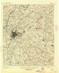
~ Atlanta GA topo map, 1:125000 scale, 30 X 30 Minute, Historical, 1895, updated 1948
Atlanta, Georgia, USGS topographic map dated 1895.
Includes geographic coordinates (latitude and longitude). This topographic map is suitable for hiking, camping, and exploring, or framing it as a wall map.
Printed on-demand using high resolution imagery, on heavy weight and acid free paper, or alternatively on a variety of synthetic materials.
Topos available on paper, Waterproof, Poly, or Tyvek. Usually shipping rolled, unless combined with other folded maps in one order.
- Product Number: USGS-5365154
- Free digital map download (high-resolution, GeoPDF): Atlanta, Georgia (file size: 9 MB)
- Map Size: please refer to the dimensions of the GeoPDF map above
- Weight (paper map): ca. 55 grams
- Map Type: POD USGS Topographic Map
- Map Series: HTMC
- Map Verison: Historical
- Cell ID: 64926
- Scan ID: 247683
- Imprint Year: 1948
- Survey Year: 1888
- Datum: Unstated
- Map Projection: Unstated
- Map published by United States Geological Survey
- Map Language: English
- Scanner Resolution: 600 dpi
- Map Cell Name: Atlanta
- Grid size: 30 X 30 Minute
- Date on map: 1895
- Map Scale: 1:125000
- Geographical region: Georgia, United States
Neighboring Maps:
All neighboring USGS topo maps are available for sale online at a variety of scales.
Spatial coverage:
Topo map Atlanta, Georgia, covers the geographical area associated the following places:
- Overlook - Slabtown (historical) - Gresham Park - Camp Creek Estates - Ellenwood Homes - Hopeful - Belvedere Park - Turner Village - Gilbert Gardens - Inglenook - Berkshire (historical) - Panola Woods - Creek Cove - Hampton Lake - Kings Ridge - Mountain View - Evans Park - Oaks of Cumberland - Lake Island Estates - Emory Highlands - Conley Downs - Pleasant Valley - Hidden Hills - Creekwood Hills - Park South - Hidden Hollow - Fairfield Farms - Creekwood Estates - Browns Mill - Five Points - Stonehenge - Oakbrook Station - Pointe South Place - Klondike - Lakewood Heights - Fay (historical) - Clairmont Park - Brownwood Acres - Weybridge - Dunwoody Corners - Otranto Hills - Sun Valley - Cooks Crossing - Pooles Mobile Home Park - Tara Heights - Brookhaven - Murphyville - Rocklane Estates - Wishing Well Hills - River Valley Estates - Cumberland Green - Tunis (historical) - Laurel Creek - Mountain View Plaza - Moonlight Forest - Country Roads - Copen Hill - Blue Creek Forest - Panola - River Oak - Edgemoor Manor - Rolling Meadows - Oak Grove - Magnet - Hillside Cottages - Dogwood Hills - Miramar - Hickory Hills - Valley View - Skyline Forest - Brooks Manor - Whitehouse - Brookwood Manor - Oak Village - Burkshire - Valley Woods - Tiffany Hills - Carrefour Place - Stoneview Acres - Beverly Hills - Deerfield - Ponderosa - Pleasant Acres - Oak Point - Devonshire - Hollydale - Adams Park - Lake City - Pinehurst - Metropolitan Mobile Home Park - Broxton Woods - Cedar Hill Estates - Cambridge Estates - Brook Glen - Snapfinger - Doral Park - Fairfield Lakes - Murphy Estates - Conyers - Rosedale Heights
- Map Area ID: AREA3433.5-84.5-84
- Northwest corner Lat/Long code: USGSNW34-84.5
- Northeast corner Lat/Long code: USGSNE34-84
- Southwest corner Lat/Long code: USGSSW33.5-84.5
- Southeast corner Lat/Long code: USGSSE33.5-84
- Northern map edge Latitude: 34
- Southern map edge Latitude: 33.5
- Western map edge Longitude: -84.5
- Eastern map edge Longitude: -84


