
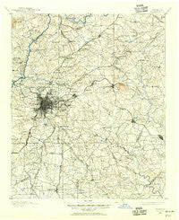
~ Atlanta GA topo map, 1:125000 scale, 30 X 30 Minute, Historical, 1888, updated 1955
Atlanta, Georgia, USGS topographic map dated 1888.
Includes geographic coordinates (latitude and longitude). This topographic map is suitable for hiking, camping, and exploring, or framing it as a wall map.
Printed on-demand using high resolution imagery, on heavy weight and acid free paper, or alternatively on a variety of synthetic materials.
Topos available on paper, Waterproof, Poly, or Tyvek. Usually shipping rolled, unless combined with other folded maps in one order.
- Product Number: USGS-5365150
- Free digital map download (high-resolution, GeoPDF): Atlanta, Georgia (file size: 9 MB)
- Map Size: please refer to the dimensions of the GeoPDF map above
- Weight (paper map): ca. 55 grams
- Map Type: POD USGS Topographic Map
- Map Series: HTMC
- Map Verison: Historical
- Cell ID: 64926
- Scan ID: 247681
- Imprint Year: 1955
- Survey Year: 1888
- Datum: NAD27
- Map Projection: Polyconic
- Map published by United States Geological Survey
- Map Language: English
- Scanner Resolution: 600 dpi
- Map Cell Name: Atlanta
- Grid size: 30 X 30 Minute
- Date on map: 1888
- Map Scale: 1:125000
- Geographical region: Georgia, United States
Neighboring Maps:
All neighboring USGS topo maps are available for sale online at a variety of scales.
Spatial coverage:
Topo map Atlanta, Georgia, covers the geographical area associated the following places:
- Mahers (historical) - Marlborough - Pine Grove Trailer Park - Briargate - Lilburn - Hillandale - Benton Harbor - Flintlook - Sioux Acres Mobile Home Park - Joel Chandler Harris Homes - Circle Creek - Berkshire (historical) - Glencastle Estates - Weybridge - Brownwood - The Landings - Castle Courts - Pinehurst - The Highlands - Manning Farms - Jarrard - Mountain Cove - Sussex Manor - Tucker - Colonial Coach Estates - Innsbrook - Brookhaven - Vinings - Lithonia - Regal Estates - Whitehouse - Stone Creek - Cedar Hill Estates - Dogwood Hills - Wyloway - Mason Woods - Druid Hills - Laurel Brook - Springview - Laurel Woods - River Oak - North Atlanta - Salem Woods - Paradise Park - Lake Villas - Arrowind - Fairfield Lakes - Littlebrooke Farm - Clearbrook - Cotton Creek - Conley - Richardson - Fay (historical) - Steeplechase - Briar Glen - Habersham - La Mancha - Bethsaida Woods - Elizabeth Park - Wildwood Estates - Edgemoor - Cabbage Town - Woodlawn Acres - Whitehall Forest Estates - Derby Hill - Heritage Station - Laurelwood - Woodfield - Wallace (historical) - Brookwood Manor - Four Winds - Graves Way - Harry Pooles Mobile Home Park - Windermere Woods - North River Crossing - Peachtree North - Woodland Park - Cedar Grove - Hidden Branches - Kirkwood - Wynterhall - Glenn Devon - Crestwicke - Ingleside - Devonshire - Stone Mill Run - Old South - Taylor Crossing - Millbrook - The Highlands at Akers - Rock Bridge - Peachtree Forest - Evans Park - Gloster - Pinebrook Heights - Saranac Estates - Pinecrest - Glen Errol - Brookwood - Edgemoor Manor
- Map Area ID: AREA3433.5-84.5-84
- Northwest corner Lat/Long code: USGSNW34-84.5
- Northeast corner Lat/Long code: USGSNE34-84
- Southwest corner Lat/Long code: USGSSW33.5-84.5
- Southeast corner Lat/Long code: USGSSE33.5-84
- Northern map edge Latitude: 34
- Southern map edge Latitude: 33.5
- Western map edge Longitude: -84.5
- Eastern map edge Longitude: -84


