
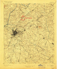
~ Atlanta GA topo map, 1:125000 scale, 30 X 30 Minute, Historical, 1895, updated 1917
Atlanta, Georgia, USGS topographic map dated 1895.
Includes geographic coordinates (latitude and longitude). This topographic map is suitable for hiking, camping, and exploring, or framing it as a wall map.
Printed on-demand using high resolution imagery, on heavy weight and acid free paper, or alternatively on a variety of synthetic materials.
Topos available on paper, Waterproof, Poly, or Tyvek. Usually shipping rolled, unless combined with other folded maps in one order.
- Product Number: USGS-5365146
- Free digital map download (high-resolution, GeoPDF): Atlanta, Georgia (file size: 9 MB)
- Map Size: please refer to the dimensions of the GeoPDF map above
- Weight (paper map): ca. 55 grams
- Map Type: POD USGS Topographic Map
- Map Series: HTMC
- Map Verison: Historical
- Cell ID: 64926
- Scan ID: 247677
- Imprint Year: 1917
- Survey Year: 1888
- Datum: Unstated
- Map Projection: Unstated
- Map published by United States Geological Survey
- Map Language: English
- Scanner Resolution: 600 dpi
- Map Cell Name: Atlanta
- Grid size: 30 X 30 Minute
- Date on map: 1895
- Map Scale: 1:125000
- Geographical region: Georgia, United States
Neighboring Maps:
All neighboring USGS topo maps are available for sale online at a variety of scales.
Spatial coverage:
Topo map Atlanta, Georgia, covers the geographical area associated the following places:
- Dunwoody West - Sara Lake Estates - Grove Park - North Atlanta - Doral Park - Valley Forest - North Fayette Estates - Franklin Farms - Elizabeth Park - Cedar Grove Acres - Mahers (historical) - Charlotte Woods - North River Crossing - Wilkshire Estates - Castile Cove - Red Gate Estates - The Wildings - Forrest Park - Orleans (historical) - Horseshoe Bend - Bretton Woods - Littlebrooke Farm - Vinings - Pinehurst - Clifton - Edgewood - Golden Acres - Oakhill - Gamma - Quail Valley - Northridge - Pinecrest Hills - Wildwood Estates - Chamblee - Cherokee Forest - Palisades Estates - Mountain Park - Plantation Woods - Westover Plantation - Overlook - Knollwood - Woodland Hills Mobile Home Park - Inglenook - Doraville - Four Winds - Hidden Lakes - Dunwoody Knoll - Lake Island Estates - Castle Courts - Tucker - Mayfair - Lochwolde - Plunket Town - Ashley Park - Thornhedge - Powers Ferry Vantage - Sibley Forest - Rockdale - Clayton Ridge - Cordova - Weather Wood - Glen Haven - Edgemoor - Edgemoor Manor - Duval - Woodmere - Rosedale Heights - Beaver Hills - Fairfield Farms - Yellow River (historical) - Springfield - Withmere - Purcell Valley - Redan - Dix-Leeson - Wesley Park - Stockbridge North - Jones Mobile Home Park - Forest Manor North - Jones Bridge Landing - Coldstream - Meadowlake - Rainbow Estates - Panola - Orchard Hills - Klondike - Homestead - Sweet Water - Trickem - Crestwicke - Tucker Mobile Home Park - Fay (historical) - Springfield Acres - Silver Ridge - Clayton Manor - Sheffield Forest - Moonlight Forest - Hapeville - Shiloh Farms - Belvedere Park
- Map Area ID: AREA3433.5-84.5-84
- Northwest corner Lat/Long code: USGSNW34-84.5
- Northeast corner Lat/Long code: USGSNE34-84
- Southwest corner Lat/Long code: USGSSW33.5-84.5
- Southeast corner Lat/Long code: USGSSE33.5-84
- Northern map edge Latitude: 34
- Southern map edge Latitude: 33.5
- Western map edge Longitude: -84.5
- Eastern map edge Longitude: -84


