
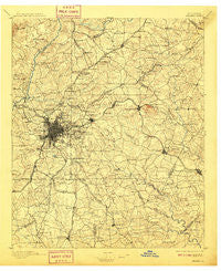
~ Atlanta GA topo map, 1:125000 scale, 30 X 30 Minute, Historical, 1895, updated 1909
Atlanta, Georgia, USGS topographic map dated 1895.
Includes geographic coordinates (latitude and longitude). This topographic map is suitable for hiking, camping, and exploring, or framing it as a wall map.
Printed on-demand using high resolution imagery, on heavy weight and acid free paper, or alternatively on a variety of synthetic materials.
Topos available on paper, Waterproof, Poly, or Tyvek. Usually shipping rolled, unless combined with other folded maps in one order.
- Product Number: USGS-5365144
- Free digital map download (high-resolution, GeoPDF): Atlanta, Georgia (file size: 9 MB)
- Map Size: please refer to the dimensions of the GeoPDF map above
- Weight (paper map): ca. 55 grams
- Map Type: POD USGS Topographic Map
- Map Series: HTMC
- Map Verison: Historical
- Cell ID: 64926
- Scan ID: 247676
- Imprint Year: 1909
- Survey Year: 1888
- Datum: Unstated
- Map Projection: Unstated
- Map published by United States Geological Survey
- Map Language: English
- Scanner Resolution: 600 dpi
- Map Cell Name: Atlanta
- Grid size: 30 X 30 Minute
- Date on map: 1895
- Map Scale: 1:125000
- Geographical region: Georgia, United States
Neighboring Maps:
All neighboring USGS topo maps are available for sale online at a variety of scales.
Spatial coverage:
Topo map Atlanta, Georgia, covers the geographical area associated the following places:
- Arrowind - Adams Crossroads - Innsbrook West - The Oaks - Greenwood Hills - Peachtree Corners - Virginia Highlands - Rock Chapel - Pointe Bleue - Edwardsville (historical) - Inman Park - Country Pine Estates - Stoneridge - Wesley Park - Timber Trace - Cordova - Danbury Village - Tolliver Heights - Forest Ridge - Castlewood Mobile Home Park - Camp Valley Estates - West Forest - Levgard Estates - Lilburn - Sarann Woods - South Kirkwood - Valley View - Chestnut Lake Estates - River Valley Estates - Pleasant Hill - Highpoint Forest - Chimney Trace - Laurel Brook - Pine Lake - Sherwood Forest - Ambleside - Briarwood - Blossom (historical) - Chattahoochee Plantation - Tiffany Hills - Wildwood Estates - Heritage Glen - Windhaven - Willowcreek - Highland Hills - Patriots Hill - River Oak - Twin Creeks - Sun Valley - Adams Park - Allendale Heights - Knollwood - Laurel Creek - Moonlight Forest - Salem West - Pleasant Hill - Pine Grove Trailer Park - Waterford - Harbin Acres - The Highlands - Maple Grove - Dogwood Acres - Club Drive - Crystal Acres - Jarrard - Pleasant Acres - Hollydale - Derby Hill - Wynterhall - Riverside - Rivergate - Hopkins Mill - Chelsea Heights - Hidden Branches - Brookhaven - Heatherwood - Post River - Blakeford - Stone Creek - Lynley Estates - Burlington - Howell Estates - Ponderosa Pines - Countryside at Cumberland - Dunwoody Heights - Skylane Hills - Capitol View - Millrun - Hammond - Summerville - Constitution - Regency Woods - Coxs Crossing - Marsh Creek - Forest Park - The Corners - Northwoods - Elizabeth Park - Riverdale - Embassy Estates
- Map Area ID: AREA3433.5-84.5-84
- Northwest corner Lat/Long code: USGSNW34-84.5
- Northeast corner Lat/Long code: USGSNE34-84
- Southwest corner Lat/Long code: USGSSW33.5-84.5
- Southeast corner Lat/Long code: USGSSE33.5-84
- Northern map edge Latitude: 34
- Southern map edge Latitude: 33.5
- Western map edge Longitude: -84.5
- Eastern map edge Longitude: -84


