
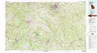
~ Athens GA topo map, 1:100000 scale, 30 X 60 Minute, Historical, 1980, updated 1981
Athens, Georgia, USGS topographic map dated 1980.
Includes geographic coordinates (latitude and longitude). This topographic map is suitable for hiking, camping, and exploring, or framing it as a wall map.
Printed on-demand using high resolution imagery, on heavy weight and acid free paper, or alternatively on a variety of synthetic materials.
Topos available on paper, Waterproof, Poly, or Tyvek. Usually shipping rolled, unless combined with other folded maps in one order.
- Product Number: USGS-5365070
- Free digital map download (high-resolution, GeoPDF): Athens, Georgia (file size: 34 MB)
- Map Size: please refer to the dimensions of the GeoPDF map above
- Weight (paper map): ca. 55 grams
- Map Type: POD USGS Topographic Map
- Map Series: HTMC
- Map Verison: Historical
- Cell ID: 67075
- Scan ID: 247618
- Imprint Year: 1981
- Woodland Tint: Yes
- Visual Version Number: 1
- Aerial Photo Year: 1974
- Edit Year: 1980
- Datum: NAD27
- Map Projection: Universal Transverse Mercator
- Map published by United States Geological Survey
- Map Language: English
- Scanner Resolution: 600 dpi
- Map Cell Name: Athens
- Grid size: 30 X 60 Minute
- Date on map: 1980
- Map Scale: 1:100000
- Geographical region: Georgia, United States
Neighboring Maps:
All neighboring USGS topo maps are available for sale online at a variety of scales.
Spatial coverage:
Topo map Athens, Georgia, covers the geographical area associated the following places:
- Glynn Isles - Deerfield - Jennings Mill - Lassiter - River Farms - Canyon Creek - Riverside Estates - Shoal Creek Farms - Rutledge - Waterton - Riverbend - Pioneer Woods - Brandy Shoals - Kirkland Acres - Millers Glen - Danson Woods - Waverly Woods - Campton - Rollingwood - Hi Roc Shores - Salem Branch - Den Court - Allens Trailer Park - Grayson - Sedgefield - Quail Run - Bostwick - Park View Homes - Beverly Heights - Oak Forest Mobile Home Park - Between - Country Club Estates - Weatherly Woods - Graystone - Bairdstown - Jamestown - Abington Park - The Jockey Club Estates - Lakeside Hills - Jersey - Salem Village - Barber Creek Estates - Bishop - Thurston - Oak Grove - Lake Wildwood - Newton Chase - The Briars - Willow Woods - Quailwood - Zingara - Broughton - Bethlehem - River Hill East - Rose Hill - Westchester - Beaver Creek - Windsor - Social Circle - Cedar Bluff - Willow Wind - Frogtown - Lexington Heights - Dorsey - Pine Ridge - Broadacres Homes - Farmington - Fernwood - Elder Ridge - Bradley - Northridge Park - Acadia Woods - Penfield - Indian Hills - River North - Greene - Overlook Village - Caruthers Mill - Eastville - Harbin - Springfield - Bethesda - Hightower Forest - Cedar Shoals Estates - Knights Landing - Dixie Village - Sandlewood - Hidden Pines - Surry Chase - Stone Lea - Rogers Heights - Gunter Estates - Country View - Newton Ridge - Temperance Bell - Union Point - Jacksonville - Crestwood Estates - Braswell - Oak Hill Farms
- Map Area ID: AREA3433.5-84-83
- Northwest corner Lat/Long code: USGSNW34-84
- Northeast corner Lat/Long code: USGSNE34-83
- Southwest corner Lat/Long code: USGSSW33.5-84
- Southeast corner Lat/Long code: USGSSE33.5-83
- Northern map edge Latitude: 34
- Southern map edge Latitude: 33.5
- Western map edge Longitude: -84
- Eastern map edge Longitude: -83


